Top attractions:
What are the Viennese Alps?
Let it be clear, technically there is no such thing as the Viennese Alps, but for pragmatic reasons, it is common to use the name “Vienna Hausberge”, when referring to the mountains, located close to the Capital of Austria. Just don‘t be mistaken, this is not Salzburg or Innsbruck – Viena is not surrounded by mountains. Unless it is a clear day and you are on a rooftop, it is impossible to see the Alps from the city itself. The Viennese Alps are, more or less, the Alps, which could be reached within an hour or two from the Capital. Basically, this includes all the mountains within Lower Austria.

On the horizon, to the right of Stephansplatz, the two peaks of Mount Schneeberg are visible. Photo by Alis Monte [CC BY-SA 4.0], via Connecting the Dots
At the first glance, due to the lack of information in English, it might look like there ain’t that many hikes in the Alps near Vienna, but the reality couldn‘t be more different. The whole country is covered by an enormous maze of hiking trails and Lower Austria is no exception. Therefore, sometimes it is hard to tell wherever it might be the beginning or the end of the hike. Nevertheless, once you get familiar with the Austrian public transport system and the regions, it won‘t be that hard to find good hikes in the Viennese Alps yourself. Believe me, it is a wonder, which will grasp you and never let apart.
2,076 m / 6,811 ft makes Schneeberg the highest mountain in the Viennese Alps. Photo by Alis Monte [CC BY-SA 4.0], via Connecting the Dots
What is requires is the first steps and let it be baby steps. You have to start somewhere. The goal of this article is exactly that – the beginners’ guide to find the best hiking trails in each region of the Viennese Alps. All of the hiking and outdoor destinations listed in this article could be reached by public transport.
Viennese Alps Details
- Region: Lower Austria
- Mountains: Eastern Alps
- Highest point: Schneebrg (2,076 m / 6,811 ft)
- Good accomondation: Payerbach–Reichenau, Puchberg am Schneeberg & Semmering
- Weather: Viennsese Alps forecast
- Emergency number: 140 and 112
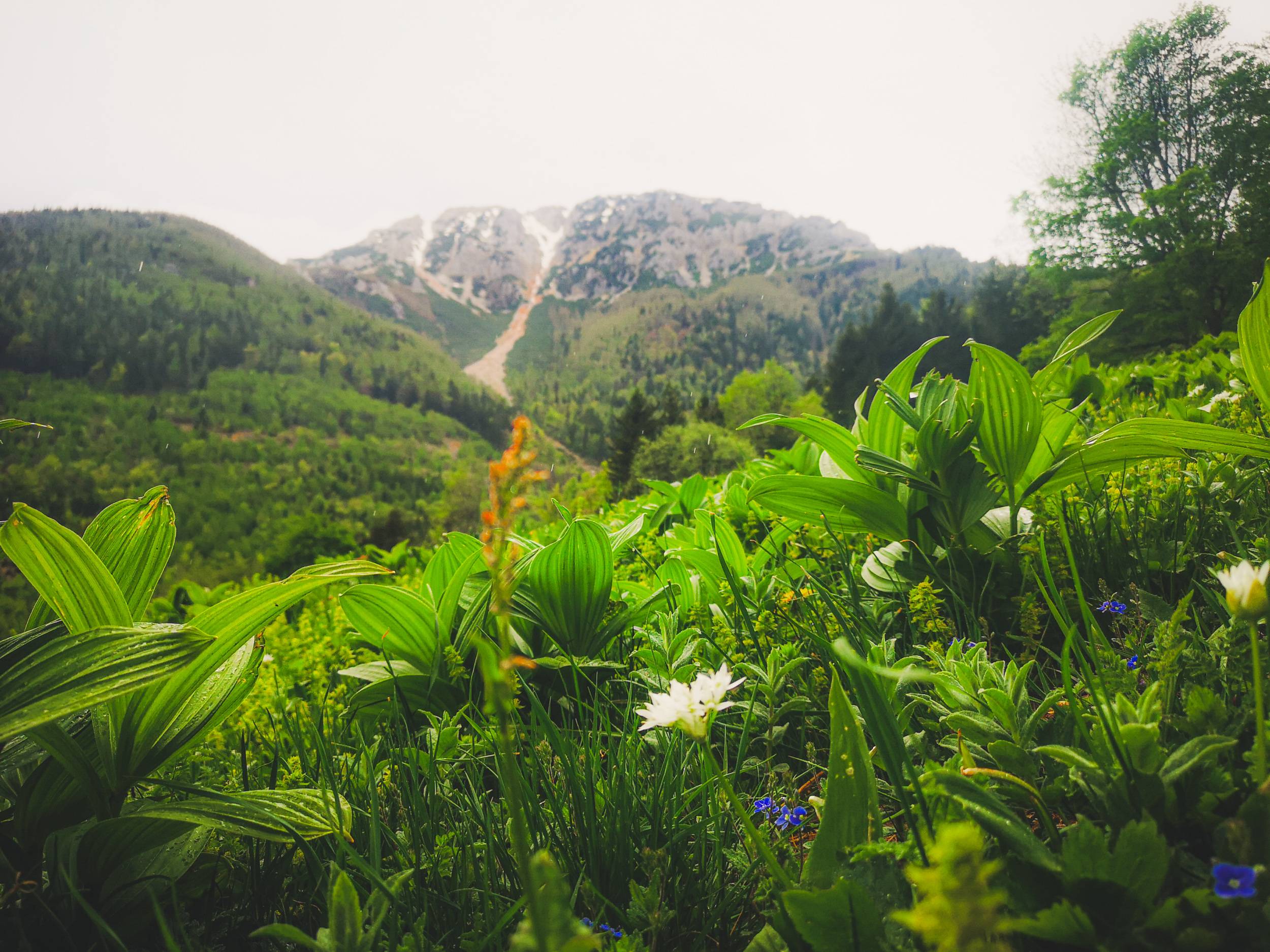
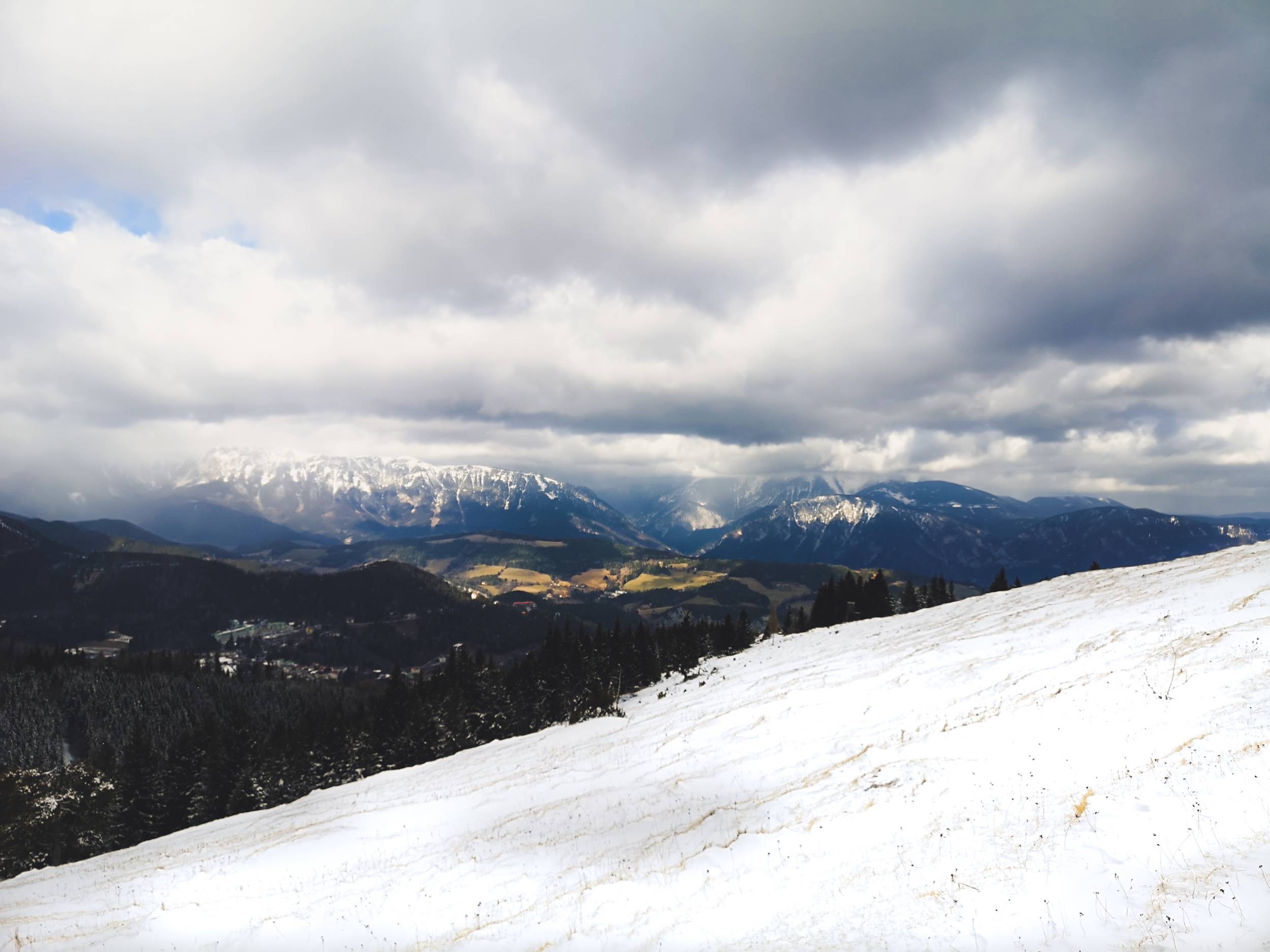
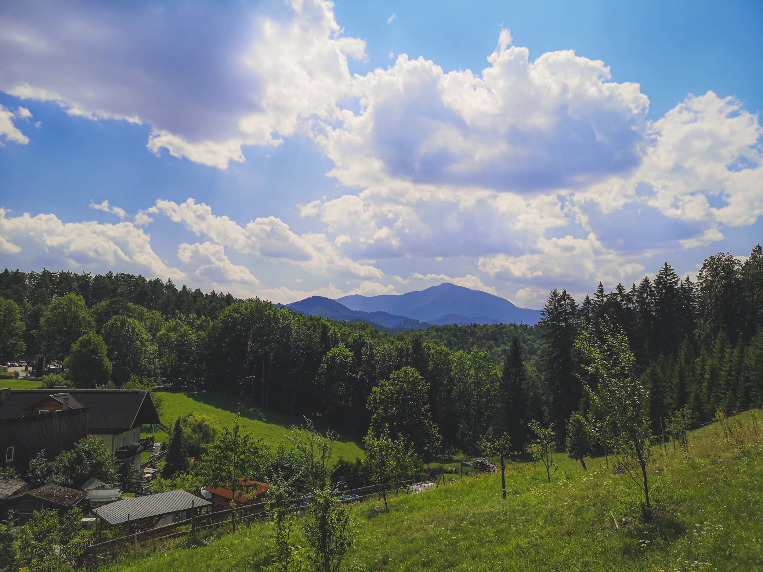
Spring might be the best time to visit the Viennese Alps. Photo by Alis Monte [CC BY-SA 4.0], via Connecting the Dots
Hiking in Semmering Pass
Without a doubt, out of all regions in the Viennese Alps, Semmering must be the best destination for casual hikers. Of course, that doesn‘t mean there is nothing to do or to see for more experienced outdoor enthusiasts. Semmering was my personal choice for the first trip to the mountains from Vienna and I keep coming back ever since. There are plenty of reasons for that.
First, Semmering has a great connection with Vienna. You won‘t need to take a bus to get into the heart of the area, the train will take you straight to it. Semmering train station is located at 895 m / 2,936 ft above the sea level, and as a matter of fact, Semmering Railway is considered to be the first true mountain railway in the world. For this reason, most of the best hiking routes are located by the railway. It connects two Austrian states: Styria and Lower Austria, this border marks the boundary between Rax-Schneeberg Group and furtherly located Mürzsteg Alps. This pretty much defines the landscape of the Semmering Pass.
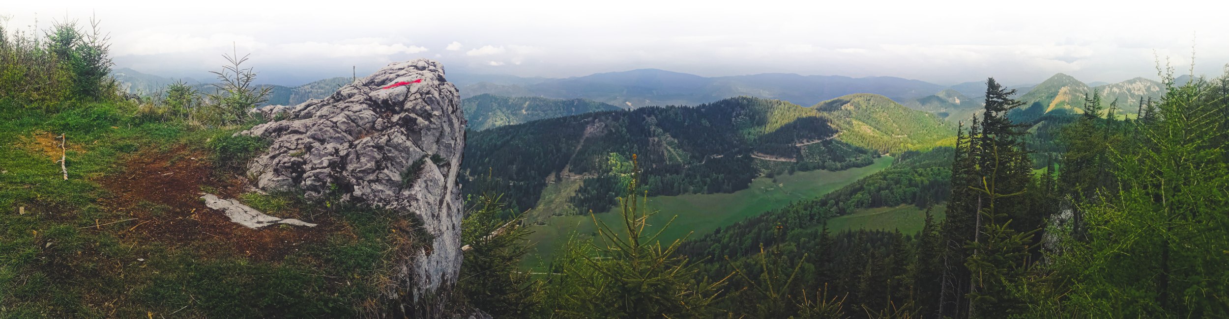
“20 Schilling Blick” is one of the most iconic viewpoints in Lower Austria. Photo by Alis Monte [CC BY-SA 4.0], via Connecting the Dots
Second, during the long years of its popularity, Semmering had more than enough time to evolve into a tourism powerhouse. Without mentioning all the things to do in Semmering, the combination of culture and nature is just great for hiking. Semmering Railway transformed this mountainous area into a historic resort, scarcely filled with old grand hotels, and every building overlooking the Viennese Alps. It doesn‘t get closer to tamed mountains than this.
Semmering Bahnwanderweg is a long but segmented hiking trail stretching along the whole railway from Glognitz to Murzzuschlag. It is probably the most popular among all hiking trails near Semmering Railway.
How to get to Semmering
- Train station: Semmering Bahnhof
- Coordinates: 47.6390° N, 15.8305° E
- Distance from Vienna: 100 km / 60 mi
- Recommended route: Wien Meidling – Weiner Neustadt – Payerbach – Semmering
- Trip duration: 2h
- Recommended ticket: Einfach-Raus Ticket 35€ / 2 people (it gets cheaper with more people)
- Fastest ticket: RJ Vienna – Graz (1h09)
- Best hiking trail: Semmering Bahnwanderweg
- Map: Semmering Railway hikes
Zauberberg Semmering cable car is a good kickstart to hiking in both winter & summer. Photo by Alis Monte [CC BY-SA 4.0], via Connecting the Dots
Hiking in Schneeberg Alps
The region surrounding Puchnberg and Schneeberg has more than 80 km / 50 mi of hiking and alpine trails. Beyond a doubt, it is one of the loveliest outdoor areas in Lower Austria and it is certainly my favorite region to hike in the Viennese Alps. After all, climbing above all has some romance in it. Though climbing Schneeberg might not be for everybody, there are plenty of hiking routes in Puchberg am Schneeberg to choose from.
Schneeberg is the highest mountain in Lower Austria and the eastern-most and the northern-most 2k+ mountain in the Alps. The statue alone is the reason for its popularity, yet there is more to connect the mountain to the Capital of Austria. If there is some right in it, Vienna claims to have the best drinking water in the world and that water comes from nowhere else but Schneeberg.
Fadensteig might be the most popular route to Schneeberg, but Wurzengraben is a better option for a less experienced hikers. Photo by Alis Monte [CC BY-SA 4.0], via Connecting the Dots
Even the Hapsburg Emperors paid their respect to the Mountain King of the Viennese Alps. The slightly lower peak of Schneeberg – Kaiserstein (2,061 m / 6,762 ft) was named in memory of the two climbings by Emperor Franz I in 1805 and 1807.
Later on, as an extension of the Puchberg Railway, it was decided to build rail tracks almost to the very top of Schneeberg – Hochschneeberg (1,800 m / 5,905 ft). It is here, Emperor Franz Joseph I had commissioned the construction for the Chapel in the memory of his late wife Empress Elisabeth (Sisi), who was murdered in 1898 by a 25-year-old Italian anarchist. Hochschneeberg was, literally, as close to the heavens as the technology of the day could bring. To this day, this is widely recognized and this tragic but romantic place is a very popular choice for many marriages.
How to get to Schneeberg
- Train station: Puchberg am Schneeberg Bahnhof
- Coordinates: 47.7671° N, 15.8056° E
- Distance from Vienna: 116.7 km / 75.5 mi
- Recommended route: Wien Meidling – Weiner Neustadt – Puchberg am Schneeberg + Losenheim
- Trip duration: 1h45 + Bus to Losenheim or Schneebergbahn
- Recommended ticket: VOR Freizeit Ticket 19€ / person
- Fastest ticket: RJ + R (1h19)
- Best Hiking Trail: Schneeberg via Fadensteig
- Map: Puchberg am Schneeberg hikes
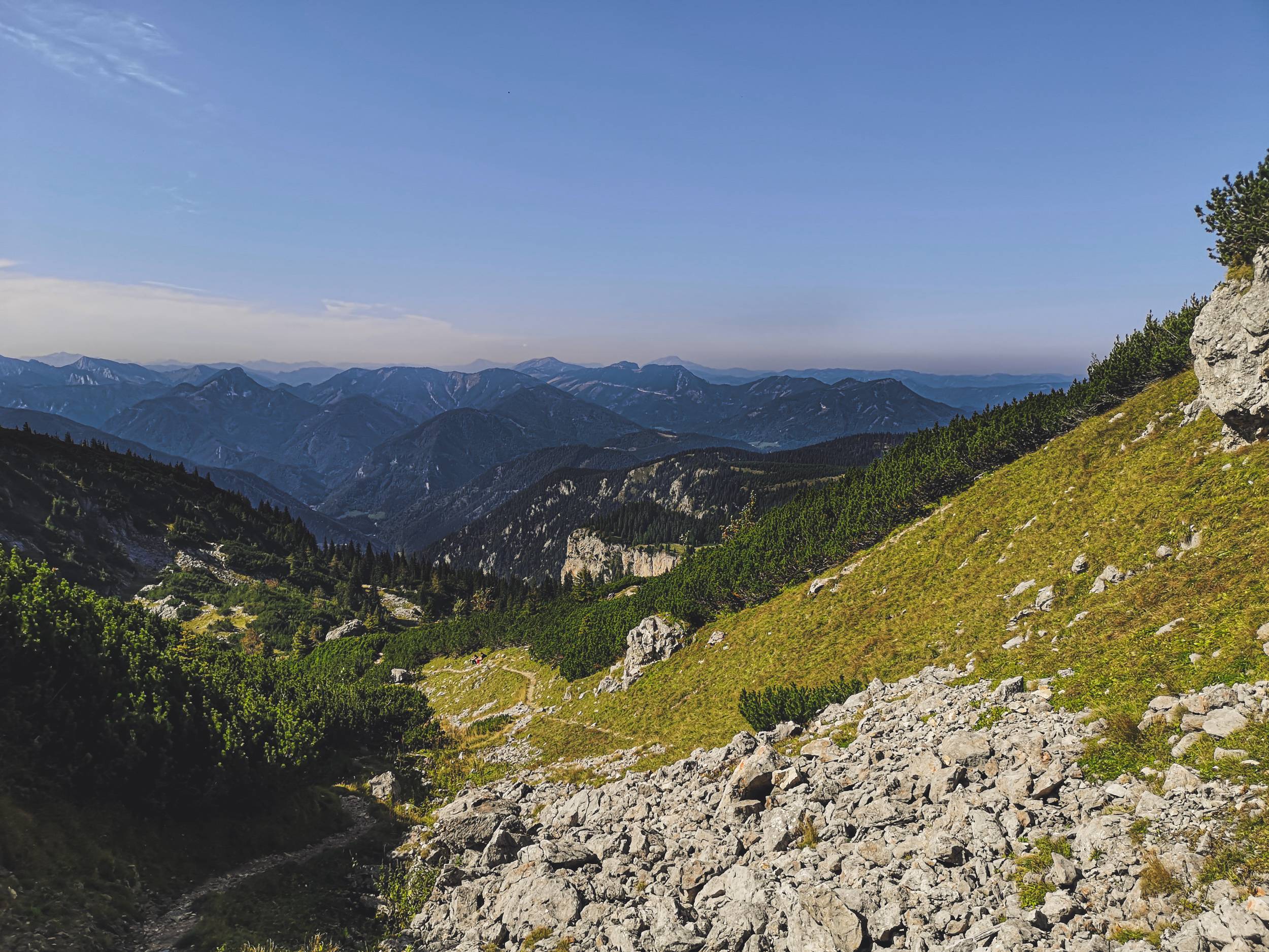
The easiest way to the top of Schneeberg is to use Schneebergbahn to Hochschneeberg and then climb the rest of 271 m / 889 ft yourself. Photo by Alis Monte [CC BY-SA 4.0], via Connecting the Dots
Hiking in Rax Alps
Technically, all these areas of the Viennese Alps listed up until now including Rax belong to the Rax-Schneeberg Mountains Group. Nevertheless, just like Semmering and Schneeberg, Rax offers a unique outdoor experience. Even the same hiking trails, could have a totally different flavor coming from the different side of the mountain range. Though Rax Mountains are surrounded by settlements, there is a clear line between the human domain and the rocky giants. Crossing that line could be a tough challenge for many hiking enthusiasts.
Schwarza Valley
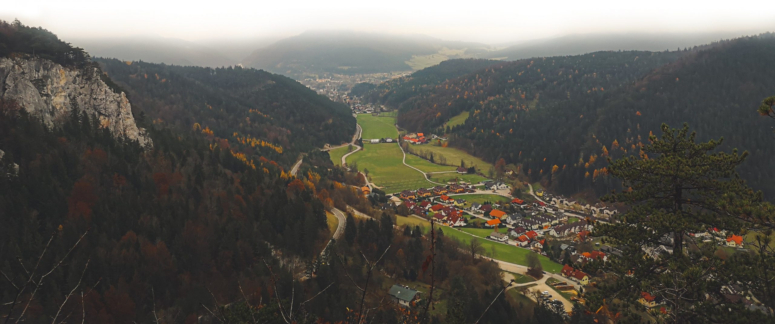
The main hub of Rax mountains is the Payerbach-Reichenau historic resort towns, located next to each other at the foot of the Alps in the Schwarza River Valley. In fact, this river might be the only reason why we have two names for the Rax-Schneeberg Mountain Group. Throughout the millennias, Schwarza has carved out even the tough mountains as this famous duo of the Viennese Alps. The testimony of this could be best observed from the south side. The obvious separation of Rax and Schneeberg mountains could be seen from afar.
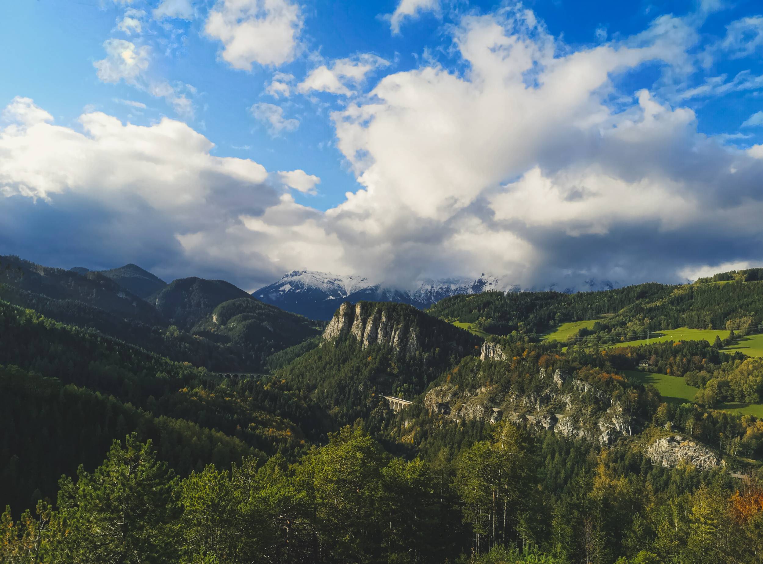
Rax Alps (left) and Schneeberg (right) is right in your face in Semmering. Photo by Alis Monte [CC BY-SA 4.0], via Connecting the Dots
Rax Seilbahn
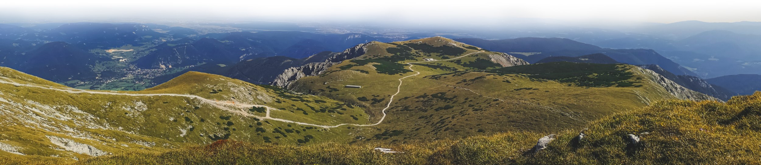
Technically, the train line, connecting Vienna with Payberbach-Reichenau Bahnhof is a part of Semmering Railway, but it might be not the most important piece of human engineering in the area. Rax Seilbahn (Rax cable car) defines most of the hiking done in the Rax Mountains. In just an instance it elevates you by more than 1,000 m / 3,280 ft, with the upper station located 1,600 m / 5249 ft above the sea level. Rax Seilbahn is a total game-changer. Once you get up to the Rax Alps like you never had a breath of fresh air. It is a different world. For that reason, many outdoor enthusiasts choose to start their hiking from the upper Rax Seilbahn station.
After getting up to the Rax Mountains one doesn’t really want to get back. Therefore, Hut-hopping is a very popular way for hiking up here.
How to get to Rax
- Train station: Payberbach-Reichenau Bahnhof
- Coordinates: 47.7012° N, 15.7402° E
- Distance from Vienna: 100 km / 60 mi
- Recommended route: Wien Meidling – Weiner Neustadt – Payberbach/Reichenau + Rax Seilbahn
- Trip duration: ~1h25 + Bus to Rax Seilbahn
- Recommended ticket: VOR Freizeit Ticket 19€ / person
- Fastest ticket: RJ + R (~1h00)
- Best Hiking Trail: Circle around Rax Plateau
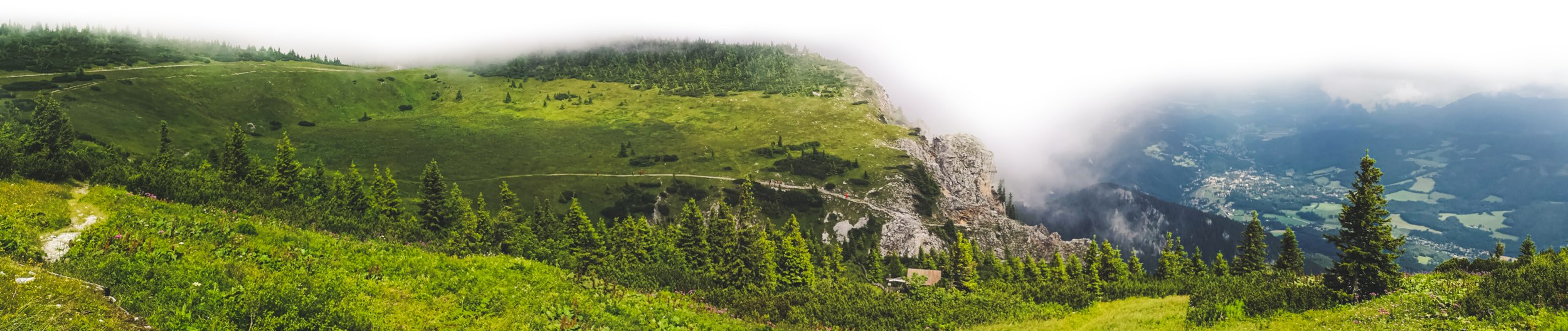
Alpine garden could be reached in half an hour from Rax Cable Car upper station. Photo by Alis Monte [CC BY-SA 4.0], via Connecting the Dots
Hiking in Höhe Wand
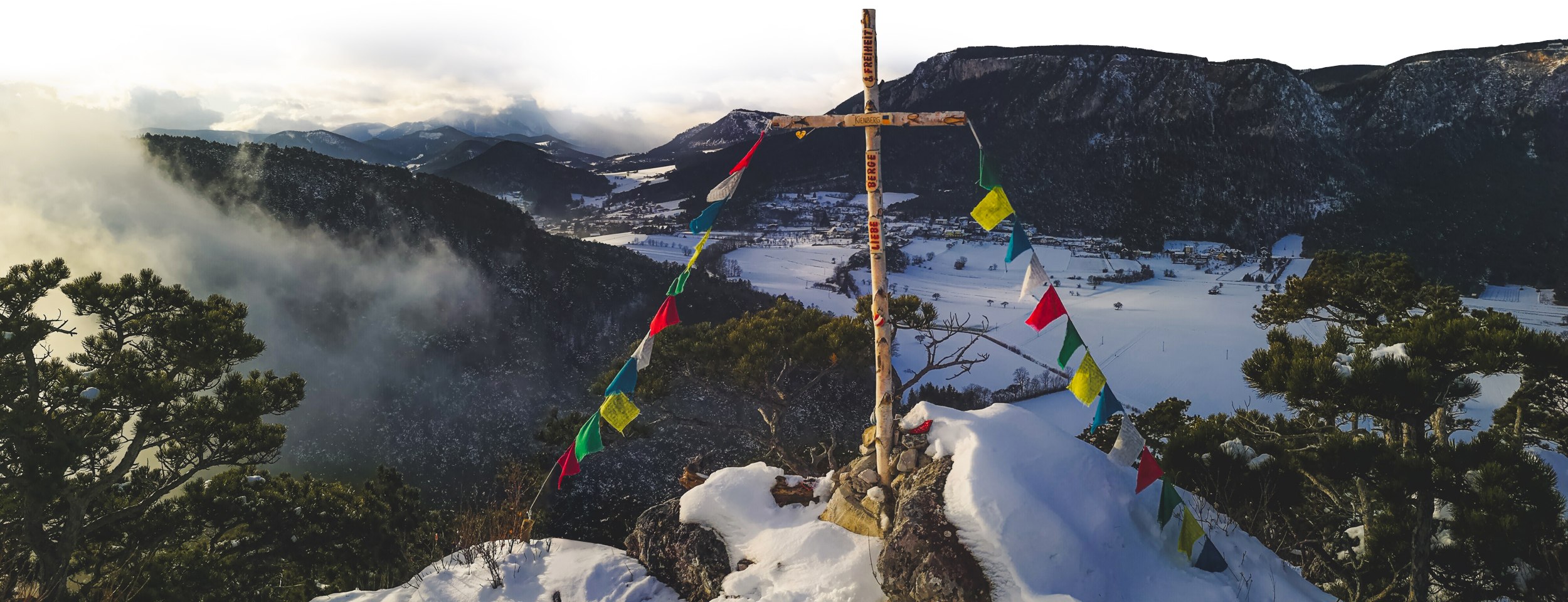
While it is impossible to get on Höhe Wand by train, at least, it is possible to get to the close area of it, which is more than enough for some of the best hiking this part of Austria has to offer. The more tenacious hikers can even climb the mountain and see the locally famous view from the top of Höhe Wand (1,135 m / 3,724 ft). Despite a few smaller mountains, like Kienberg, the high wall faces the plains of Vienna, offering an exceptionally wide scenery. Given good conditions, a keen eye could even see Lake Neusiedl from Höhe Wand.
Most popular parts of Höhe Wand like the skywalk and wild-game park is dominated by day-trippers by car. Luckily, the vast area on the top of the mountain is enough for everyone. The best train stations for hiking around Höhe Wand are: Grunbach am Schneeberg, Rothenberg and Willendorf from Schneeberg side; Waldegg from Gutenstein side.
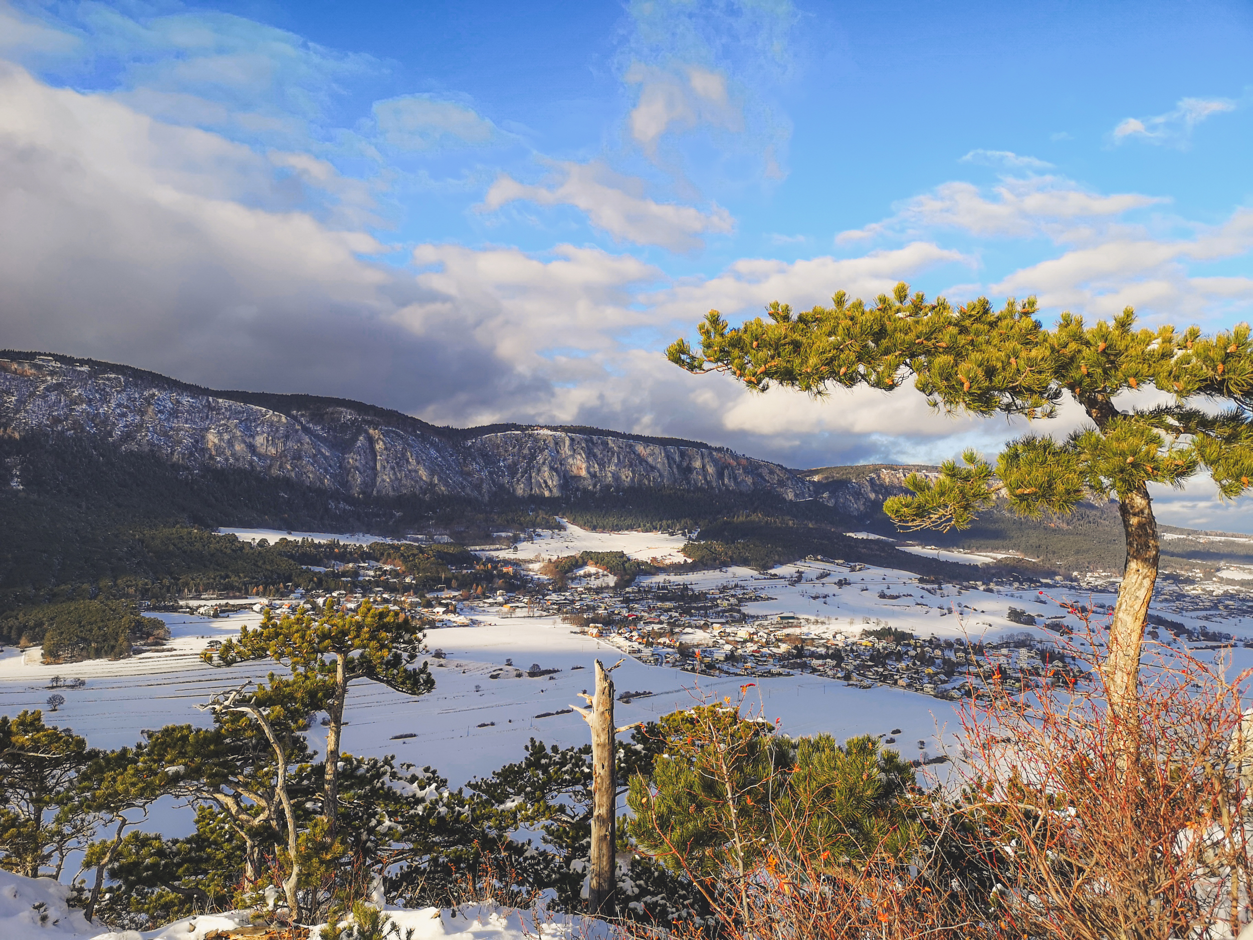
Hohe Wand from Kienberg viewpoint. Photo by Alis Monte [CC BY-SA 4.0], via Connecting the Dots
Kienberg
Höhe Wand is not only perfect for breath-taking views, but it is actually quite a sight itself. There is probably a no better spot for embracing the high wall of Höhe Wand than from a small mountain right in front of it – Kienberg 650 m / 2,133 ft. The peak of it could be reached within an hour from Willendorf or Rothengrub train station. Climbing Kienberg will take about 2.4 km / 1.49 mi of walking and about 250 m / 820 ft of ascending. Most of the hike will take in a very peaceful pine forest at the foot of the mountain, next to Willendorf.
How to get to Gutenstein Alps
- Train station: Grünbach am Schneeberg train station
- Coordinates: 47.8413° N, 16.0585° E
- Distance from Vienna: 68.4 km / 42.5 mi
- Recommended route: Wien Meidling – Weiner Neustadt – Grünbach am Schneeberg
- Trip duration: ~1h30
- Recommended ticket: VOR Freizeit Ticket 19€ / person
- Fastest ticket: RJ + R (~1h05)
- Best Hiking Trail: Skywalk – Naturpark Hohe Wand loop
You can even see Schneeberg from Kienberg. Photo by Alis Monte [CC BY-SA 4.0], via Connecting the Dots
Hiking in Türnitz Alps
Situated at the outer layer of the most famous mountains in Europe, Türnitz Alps raises only 1,400 m / 4,593 ft at Grosser Sulzberg. Despite that, this mountainous region offers countless different hikes throughout its wild forests. Türnitz Alps are scarcely populated, therefore it is almost entirely covered by trees. This feature makes this part of the Alps distinctive and could be only mistaken with the neighbouring Gutenstein Alps.
Given that, it is not entirely obvious where one should travel for the best hiking experience in Türnitz Alps. The regional center, Town Türnitz is an obvious choice but towns like Lilienfeld or Schrambach has much better access. It is also possible to make a round trip all the way to Mariazell but Türnitz Alps might be not the most interesting hiking destination from the picturesque Styrian village.
How to get to Türnitz Alps
- Train station: Grünbach am Schneeberg train station
- Coordinates: 47.8400° N, 15.3900° E
- Distance from Vienna: 99.8 km / 62 mi
- Recommended route: Wien Westbahnhof – St Pölten – Lilienfeld/Türnitz
- Trip duration: 1h25 – 1h45
- Recommended ticket: VOR Freizeit Ticket 19€ / person
- Fastest ticket: RJX + R (~1h15)
- Best Hiking Trail: Climbing Hohenstein
Vista of Lilienfeld from Mount Parapluie (587 m / 1,926 ft). Photo by Alis Monte [CC BY-SA 4.0], via Connecting the Dots
Hiking in Gutenstein Alps
This magical region is often left overlooked by many outdoor enthusiasts. Not because Gutenstein Alps lack charm, but it rather doesn‘t have as much „presence online“ as its cousins. Some might find Gutenstein Alps not as appealing due to the absence of rocky high mountains, but it wasn‘t the case for many artists, who found inspiration in the green idyllic valleys of the region, carved out by Piesting and other rivers. Yes, Gutenstein Alps are the lowest of all mountain ranges on the list, but that is as much as an advantage as a disadvantage.
Myra Waterfalls
If there was only one place worth visiting in Gutenstein Alps, it must be the Myrafalls. These beautiful waterfalls are located just about 3 km / 1.86 mi from Pernitz-Muggendorf train station, following Piesting‘s tributary – Myrabach – upstream. This protected natural wonder stretches over 600 m / 1968 ft horizontally and 70 m / 230 ft vertically. It wouldn‘t be Austria if there wasn‘t a hiking path built over the Myrafalls with countless bridges over cascades, enabling the observation of all waterfalls from every possible angle. Even with 5€ entry fee, this natural wonder is filled with visitors. Certainly, it must be the most popular destination in Gutenstein Alps.
Once you are at the upper end of Myraffals hiking route, be sure to climb to the top of Hausstein (668 m / 2191 ft) for the surprisingly gorgeous vista of the surrounding mountains and Myrabach valley.
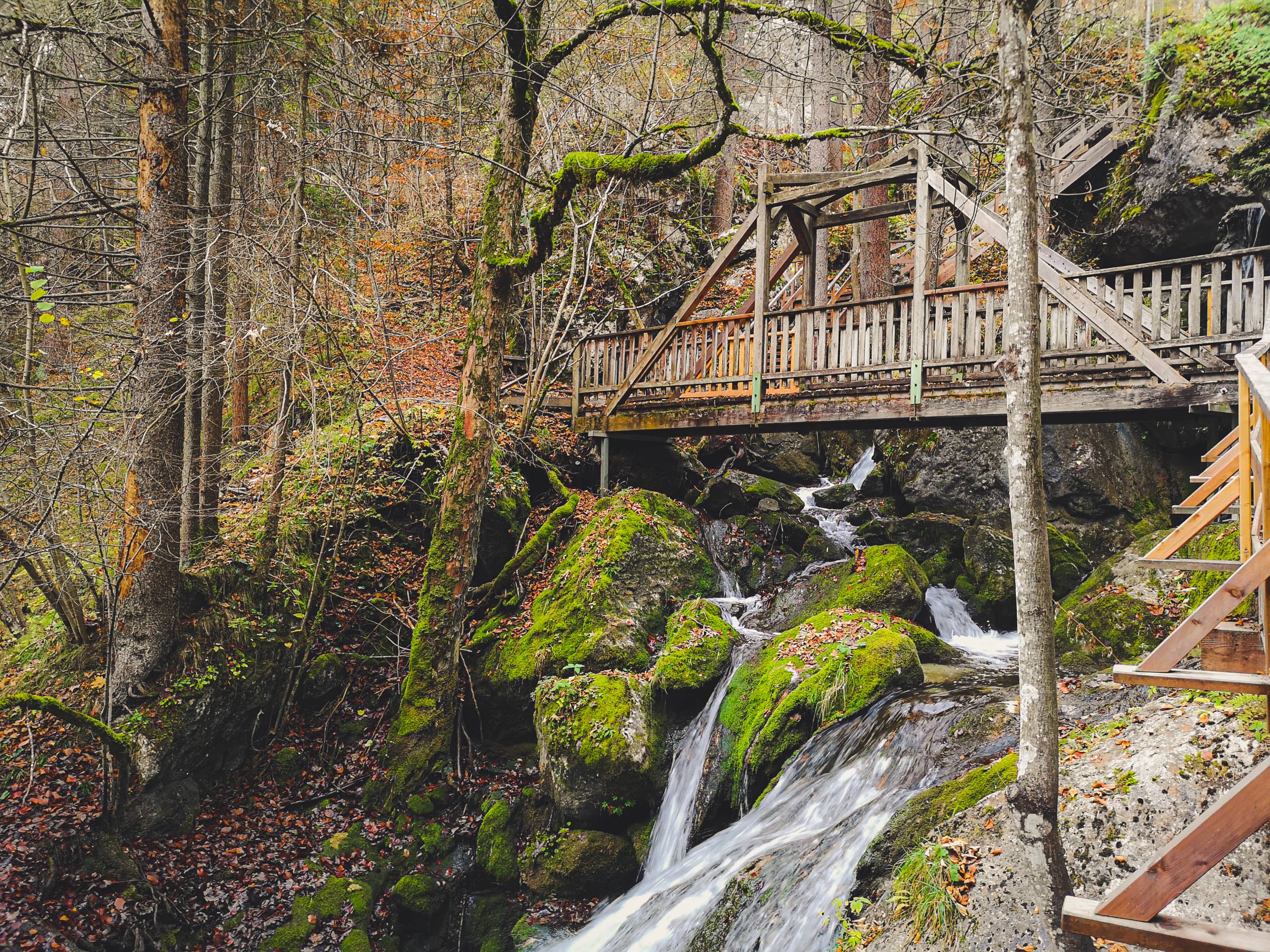
Myrafalls is a 600m / 1,968 ft hiking route over the cascades of Myrabach river with waterfalls dropping 70m / 230 ft in total. Photo by Alis Monte [CC BY-SA 4.0], via Connecting the Dots
Gutenstein
The heartland of the region lies deeper in Gutenstein Alps. You can tell so from its name – Gutenstein, or THE Gutenstein. The deep history of the town, including two castles with a monastery of Servite Order on a nearby mountain (Mariahilfberg), and the natural location for a settlement – the junction of Piesting river and its two tributaries (Steinapiesting and Längapiesting) is a perfect storm for artistic inspiration. From all of them, the most famous artist who found its muse in Gutenstein was a dramatist and actor – Ferdinand Raimund. There is even a museum dedicated to him in the town. If you are a foreigner, you might not know Ferdinand Raimund, but then again – visit the museum.
In reality, Gutenstein might feel underappreciated, but it makes this town even more attractive. Among the other centers of their perspective region, Gutenstein is the only one that feels like an authentic town rather than a resort. This includes that unique Austrian alpine life flavor, which is not that easy to get around the big cities, especially Vienna.
Mariahilfberg is the most popular tourist destination in Gutenstein itself, Schneeberg could be seen from the mountain on a clear day. Photo by Alis Monte [CC BY-SA 4.0], via Connecting the Dots
An obvious disadvantage of its unpopularity is that you are going to need a travel guide to visit Gutenstein without missing any of the goodies the town has to offer. Gutenstein might not be your first choice among the regions of the Viennese Alps, but I guarantee you that you won‘t be disappointed.
How to get to Gutenstein Alps
- Train station: Gutenstein Bahnhof
- Coordinates: 47.9500° N, 15.6500° E
- Distance from Vienna: 73km / 45mi
- Recommended route: Wien Meidling – Weiner Neustadt – Gutenstein
- Trip duration: ~1h30
- Recommended ticket: Einfach-Raus Ticket 35€ / 2 people (it gets cheaper with more people)
- Fastest ticket: RJ + R (1h13)
- Best Hiking Trail: Piestingtal
- Map: Gutenstein Alps hikes
The scenic view from the top of Hausstein, the rock of Myrafalls. Photo by Alis Monte [CC BY-SA 4.0], via Connecting the Dots
Tours From Vienna to the Alps
At the moment, the tours‘ market of day trips from Vienna to the Alps is dominated by Hallstatt trips. This is not necessarily bad, but knowing the variety Austria has to offer, it is somewhat a pity. Nevertheless, the demand moves the supply, thus I assume many tourists want to see the magical Hallstatt. I have to confess, once I got my first opportunity to visit the town – I did it, and I have to admit that Hallstatt is very beautiful, even by the Austrian standards.
Finally, If you don‘t have much time exploring the Austrian mountains, visiting Hallstatt might be a perfect day trip from Vienna to the Alps. Given that the legendary town is located in the Dachstein Mountains, you might even see much higher mountains than Schneeberg. Having traveled quite a bit in both Styria and Salzkammergut I have to say that a lot depends on the route of the tour. In my own opinion, these should be the best day trip tours from Vienna to Hallstatt.
- From Vienna: Panoramic Austrian Alps Tour to Hallstatt (13h00 | € 119/person)
- From Vienna: Full Day Trip to Hallstatt and Salzkammergut (1day | € 119/group)
- From Vienna: Hallstatt and Alpine Peaks with Skywalk Lift (13h00 | € 119/group)
All of these tours are curated by GetYourGuide, therefore you can cancel up to 24 hours in advance to receive a full refund.
Personal Recommendation
Lastly, I have to mention that since I visited all of these wonderful regions of the Viennese Alps several times for various hiking trails, picking just one is a tough choice. Having said that, it only shows that whichever region you will choose, I bet you are not going to regret it. Putting personal experience aside, it is much easier to give a recommendation thinking rationally. After doing my research I chose Semmering for my first trip, and even after all this time I would recommend the same area for the first hiking day trip to the Viennese Alps.
No matter how many times I visit the Alps, it always capture me as if I see them for the first time. Photo by Alis Monte [CC BY-SA 4.0], via Connecting the Dots
That goes even with the acknowledgement that Rax-Schneeberg Group has the highest and the most beautiful mountains in Lower Austria. Still, if you have no plans of climbing them, we have to agree that the mountains are more beautiful from afar rather than at the foot, right? This is where Semmering comes in as a perfect destination.
Due to the nature of the Semmering Railway, the train will bring you straight to the Alps, ~900m / 2,953 ft above sea level. Once you get out of the wagon, it doesn‘t take much climbing to have Rax-Schneeberg Group in front of your eyes. It is like killing two birds with one stone. That goes even without mentioning that experiencing the Semmering Railway from a train is a trip of its own, and all the infrastructure built because of this human engineering miracle makes hiking around Semmering Railway a real joy.
All content and photos by Alis Monte. If you want to collaborate, contact me on info@ctdots.eu Photo by Alis Monte [CC BY-SA 4.0], via Connecting the Dots
Frequently Asked Questions
How many Vienna Alps are there?
Many describe Rax-Schneeberg Group as the mountains of Vienna, but for pragmatic reason I would distinguish four regions: Semmering, Schneeberg, Rax and Gutenstein Alps.
How far are the Alps from Vienna?
The closest true mountain of the Alps is considered to be Schneeberg (2,076 m / 6,811 ft). It is located 116.7 km / 75.5 mi from Vienna.
Can I get to the Alps from Vienna by public transport?
Yes, there are four main destinations from Vienna to the Alps, which could be reached by train in 1-2h: Semmering, Puchberg am Schneeberg, Payerbach-Reichenau & Gutenstein.
What is the highest mountain near Vienna?
The highest mountain in Viennese Alps is Schneeberg (2,076 m / 6,811 ft).
What is the distance from Vienna to the Alps?
It is about 100 km / 60 mi.
Can you see the Alps from Vienna?
Don‘t be mistaken, this is not Salzburg or Innsbruck - Viena is not surrounded by mountains. Unless it is a clear day and you are on a rooftop, it is impossible to see the Alps from the city itself.
How far is Vienna from the Alps?
The local Vienna mountains, or the Alps, could be reached within an hour or two from the Capital.
How do I get from Vienna to the Alps?
Arguably the best way to travel from Vienna to the Alps is by the public transport. The main hiking hubs could be reached by trains and from there you can catch a bus to travel to the desired destinations.