June 16, 2023
Self-guided 3-Day Section Trek Itinerary of Alta Via 1 in the Dolomites
Active life, Earth Science, Experience, Guide, History, Itinerary, Trekking
Top attractions:
About the Dolomites
For a mountain range with the highest peaks reaching just over 3.000 m / 9.843 ft, the Dolomites are surprisingly popular. The reason for that could be either its violent history, the white-colored rock or simply its beauty. Leaving the past events which took place in these majestic mountains, for now, most nature lovers would agree that the Dolomites are unique in their shapes and colors. Both features are all thanks to the special type of sedimentary rock, which is called – surprise surprise – dolomite. It was discovered in 1789 by Deodat de Dolomieu, when he decided to analyze the pale white rocks. Dolomite naturally attracted him in the same manner as does attract us today, but since he was the first to notice the rock – dolomite was named after him.
The snow-resembling whiteness of dolomite rock is just one side of the coin, its chemical composition gives it another interesting feature. Dolomite is surprisingly strong, making it very resistant to various erosive events like weathering. The rock deposits below the dolomite layer don’t have these features, therefore it is continuously being degraded by various factors. This combination results in stone bastions we all know and love the Dolomites for. Many typical peaks of the mountain range have similar characteristics of solid tall walls, surrounded by broken-down rocks. This geological phenomenon created an exceptional area, which is renowned not only for its extraordinary beauty but for uncovering many secrets of the deep past, making a great service to the fields of earth sciences. For these reasons, the Dolomites were granted UNESCO World Heritage Site status in 2009.
The Dolomites have 18 peaks rising more than 3 000 m / 9 843 mi above sea level. Photo by Alis Monte [CC BY-SA 4.0], via Connecting the Dots
About Alta Via 1
There are about dozen Alta Via routes in the Dolomites but none are sought as much as the no 1. The reason for that is probably the unexpectedly large number of various-shaped mountains, combined with the relative easiness of the trail. The geological features of the Dolomites are interesting not only to scientists but inspire many artists and travelers, who get the same treatment in this trek as in Camino de Santiago. Alta Via 1 runs between Lago di Braies and Belluno, the latter has excellent connections and the first one could be reached by bus.
Alta Via 1 probably is at the top of the most popular trekking routes in Europe, falling just behind Tour Mont Blanc. The whole stretch of the trek covers about 125 km / 77.67 mi and 7.3 km / 4.5 mi ascend. In normal conditions, the distance is usually completed in about two weeks. A typical day could require About 7 hours of walking and about 800 m / 2.625 mi of ascend. My group chose to challenge it within 6 days, making the daily load much higher. Personally, I decided to stick with half of the route, but my friends have completed Alta Via 1 as they have intended. Numi.World, who planned the trip has an article, where you can read more about the Alta Via 1 trek within six-day, while in this article I stick to my guns.
Dolomite has formed quite frequently in the past, but it no longer does in modern times – it is called the dolomite problem. Photo by Alis Monte [CC BY-SA 4.0], via Connecting the Dots
History of Alta Via 1
The history of Alta Via 1 is a tragic one. If it was not for World War I, hiking in the Dolomites probably would’ve looked totally different. The core of Alta Via is the various points and the actual paths the soldiers used during the war. Out of 150.00 Italian soldiers, who perished during the conflict, only one-third were killed by the direct actions of Austro-Hungarians. Others have died because of the mighty and harsh nature of this terrain. I cannot help but wonder how the men have managed to chase their senseless goals in the shadow of a much more powerful nature. I find it very troubling because these mountains have brought me many positive memories.
Alta Via 1 Details
- Starting point: Lago di Braies
- Target point: Belluno
- Distance: 125 km / 77.67 mi
- Ascend: ~7 300 m / 23 950 ft
- Descend: –
- Duration: 12 days
- Difficulty: Hard – T (Tourist) – EEA (Expert Hikers with Equipment)
3-Day Itinerary Details
- Starting point: Lago di Braies
- Target point: Rifugio Palafavera
- Distance: ~60 km / 37,28 mi
- Ascend: 4 010 m / 13 156 ft
- Descend: –
- Duration: 8-10 h
- Difficulty: Hard – T (Tourist) – EEA (Expert Hikers with Equipment)
Map of Alta Via 1
Day 1: Lago di Braies – Rifugio Biella – Rifugio Fanes
The first-day section of Alta Via 1 leads us entirely through Fanes-Sennes-Braies National Park and covers two stages of the standard Alta Via 1 itinerary:
- Stage 1: Lago di Braies – Rifugio Biella (Ascent: 900 m / 2 953 ft);
- Stage 2: Rifugio Biella – Rifugio Fanes (Ascent: 565 m / 1 854 ft).
Dolomite used to be called magnesian limestone because its chemical formula is very similar except for magnesium. Photo by Alis Monte [CC BY-SA 4.0], via Connecting the Dots
About Fanes-Sennes-Braies
Founded in 1980, it is the third-biggest park in South Tyrol. Fanes-Sennes-Braies is not only listed among the UNESCO World Heritage sites but is also included in Natura 2000. The park’s main function is to preserve these pristine and spectacular landscapes while maintaining leisure activities for its visitors. As a trespasser, don’t forget to respect the natural status quo.
Trail Stage Details
- Starting point: Lago di Braies
- Target point: Rifugio Fanes
- Distance: 21 km / 13 mi
- Ascend: 1 465 m / 4 806 ft
- Descend: –
- Duration: 3 – 6 days
- Difficulty: Hard – E (Hike)
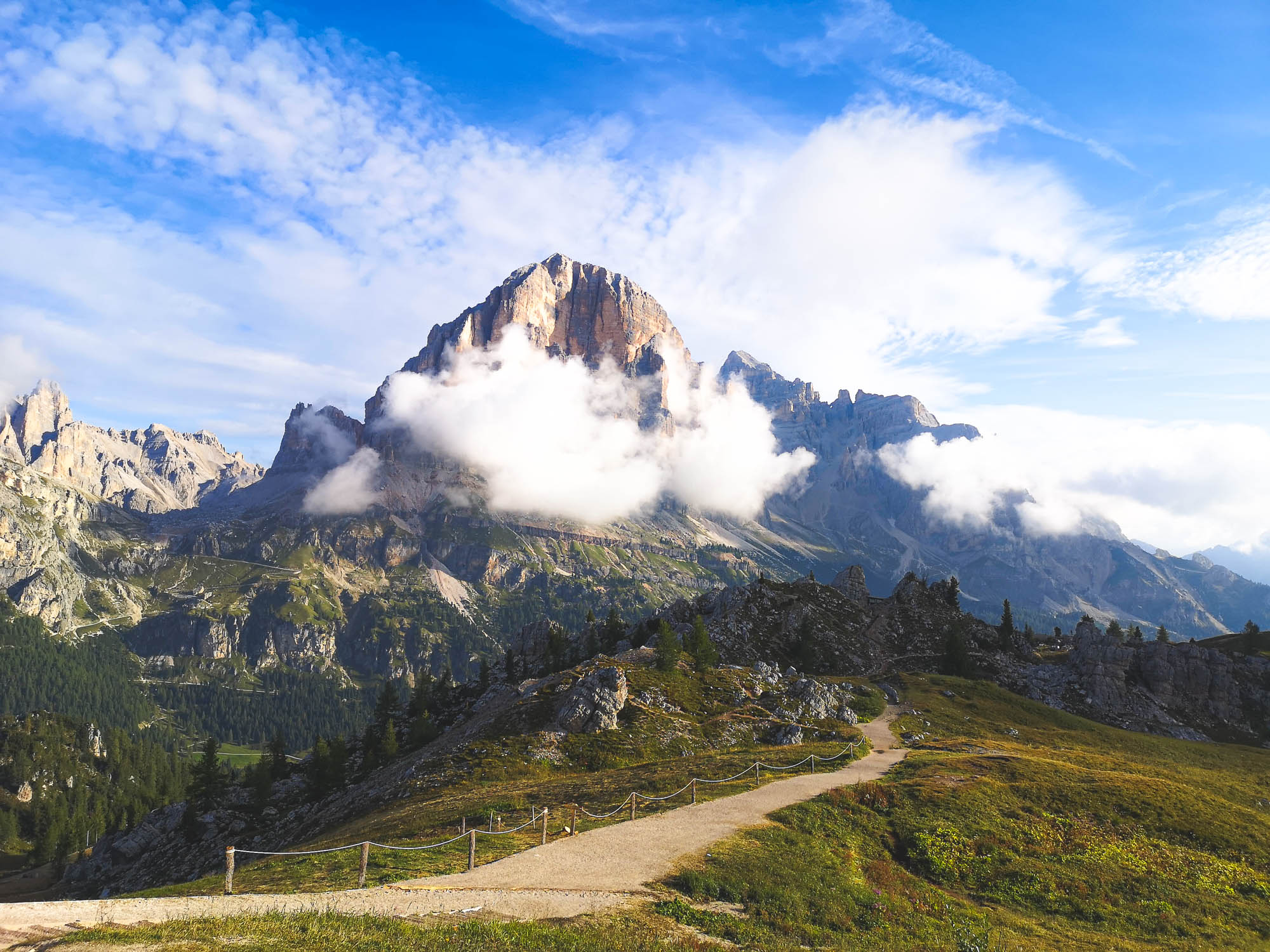
The Highlights of Day 1
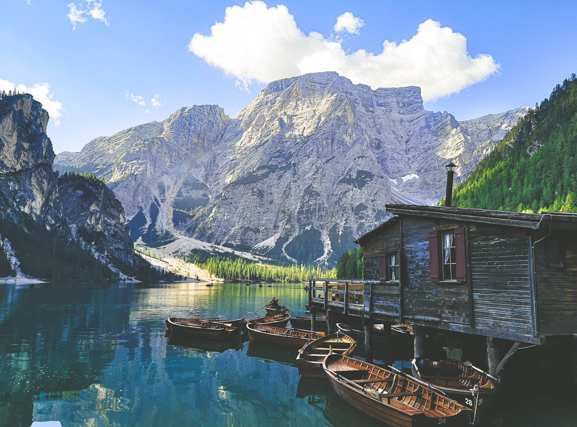
The famous boat hut in Lago di Braies. Photo by Alis Monte [CC BY-SA 4.0], via Connecting the Dots
Lago di Braies
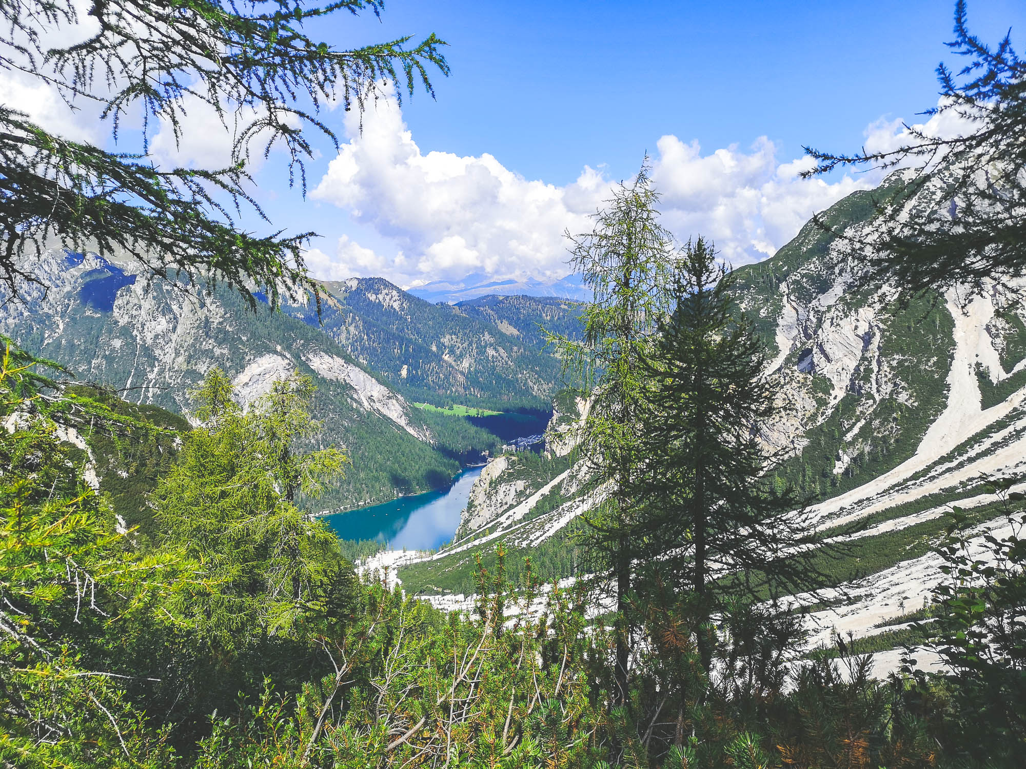
Lago di Braies is one of the most picturesque lakes on the old continent. It has the nickname of the Pearl of Alps because thousands, if not millions, of visitors, come to embrace the majestic beauty of the lake annually. As a result, you can find countless photographs of Lago di Braies mirroring Croda del Becco online, but have you ever wondered how does the lake look like from up above?
Lago di Braies from atop. Photo by Alis Monte [CC BY-SA 4.0], via Connecting the Dots
It so happens that Lago di Braies is also the starting point of one of the most famous treks in Europe – Alta Via 1 and it might be the most difficult one because it is almost impossible to leave this majestic lake behind and begin climbing Croda del Becco.
Croda del Becco (2 810 m / 10 394 ft). Photo by Alis Monte [CC BY-SA 4.0], via Connecting the Dots
Croda del Becco
Also known as Seekofel (ger.), Croda del Becco (2 810 m / 10 394 ft) is the Narcissus of the scenic Lago di Braies. Its beautiful reflection on the lake doesn’t fail to amaze a single visitor, I bet the mountain itself is happy with what it sees.
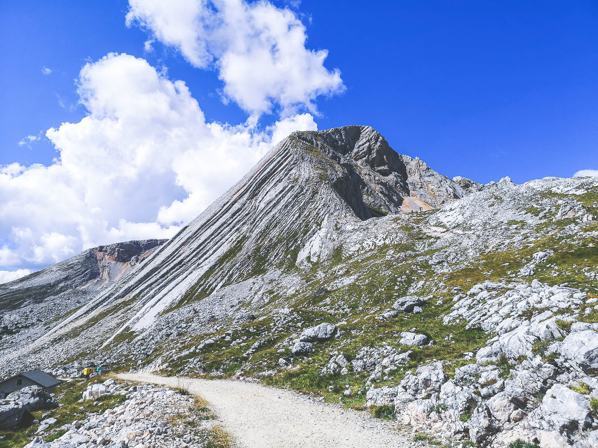
The first stage of Alta Via 1 is basically the ascension to the top of Croda del Becco. Once you get on the mountain pass (2 376 m / 7 795 ft) there is not that much left to reach the peak of it. If you follow the standard 12-day itinerary, you might as well have time, or strength, to do that.
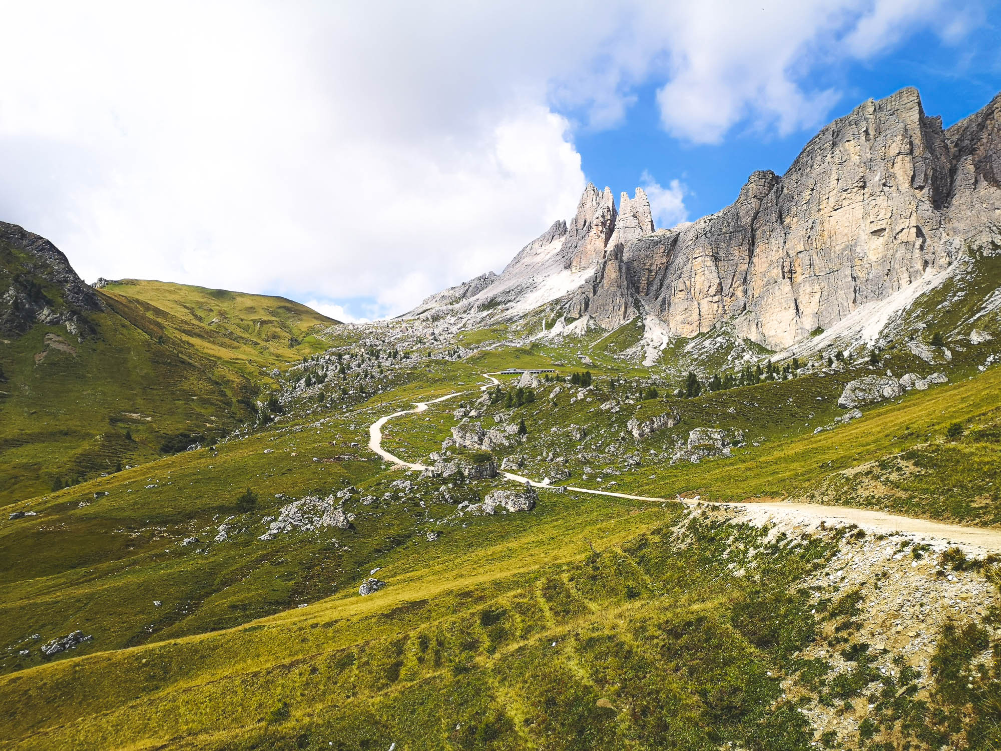
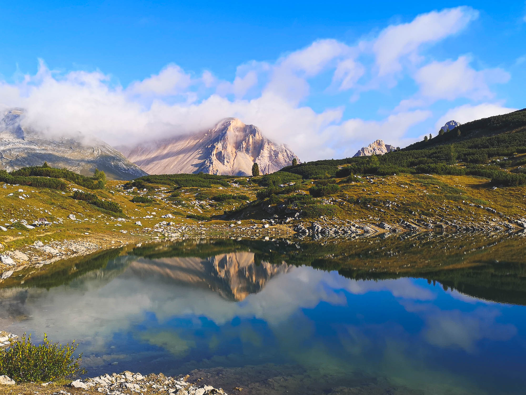
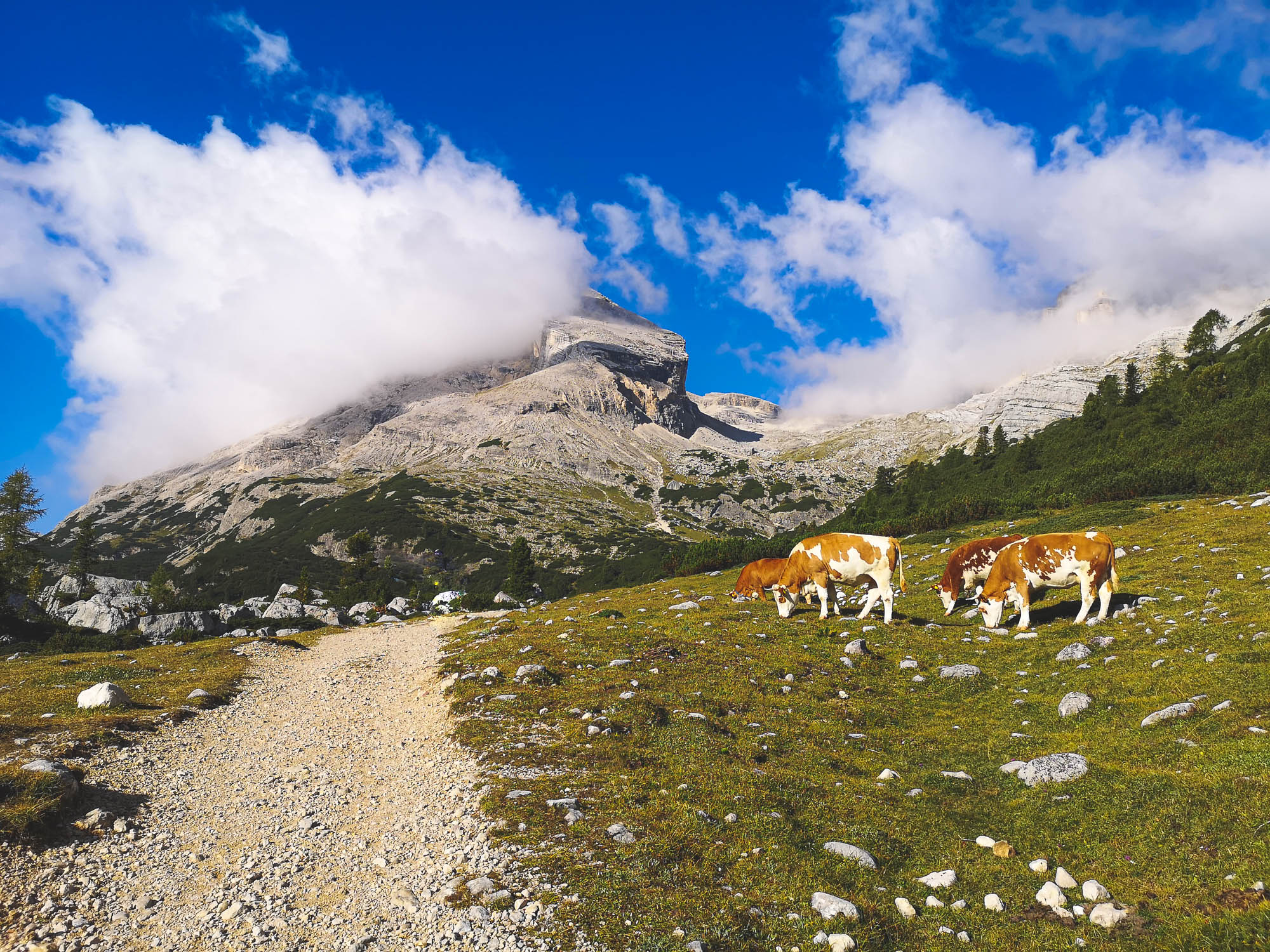
A plateau in the Sennes mountains, a perfect spot to spot a Marmot. Photo by Alis Monte [CC BY-SA 4.0], via Connecting the Dots
Sennes
Another central piece of Fanes-Sennes-Braies National Park. Basically, Senes is a high plateau between Croda del Becco and Fanes, making it a perfect place to look out for edelweiss and marmots! Many other iconic mountains of the Dolomites are visible from here like Mount Cristallo (3 221 m / 10 568 ft), Höhe Gaisel (3 146 m / 10 322 ft) Sorapis (3 205 m / 10 515 ft) and Tofane (3 243 m / 10 640 ft).
Tamersc/Rautal Valley is one of the access points by car to the deeper part of the Dolomites. Photo by Alis Monte [CC BY-SA 4.0], via Connecting the Dots
Tamersc/Rautal Valley
There is no particular reason for Tamersc to be mentioned if it wasn’t for its beauty. Through the ages, a mountain stream has carved out this Valley making a canyon and separating Sennes from the Fanes Mountains. Tamersc is impossible to miss and the very end of the valley near Rifugio Pederu could be reached by bus.
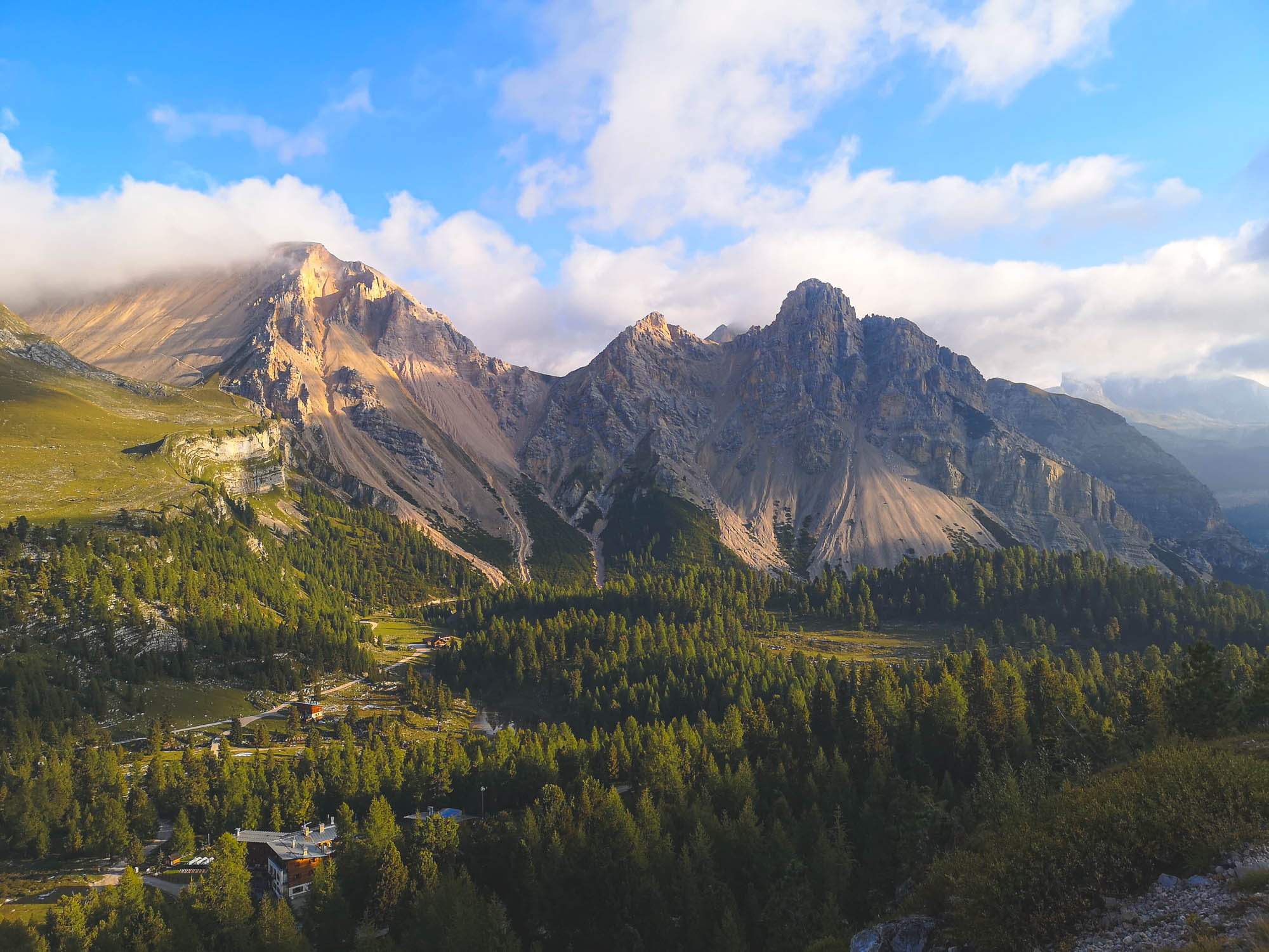
Waking up in the Fanes mountains is a bliss of unspoken beauty. Photo by Alis Monte [CC BY-SA 4.0], via Connecting the Dots
Fanes
Undoubtedly, Fanes Mountain Group must be one of the best-known parts of the Dolomites. It is widely acknowledged for its beauty and unique mountain shapes, especially by ski tourers. Fanes are the central location of some of the legends of the local people, known as Ladin. Unsurprisingly, this magical world disconnects you from reality, even a mobile connection hardly penetrates the mountains. To me, Fanes felt like a special place but I won’t go into the details here, you can read more about the Ladin legends of the Fanes Kingdom and its warrior Princess in another article.
A morning light panorama of the Fanes mountains – a picture worth a thousand words. Photo by Alis Monte [CC BY-SA 4.0], via Connecting the Dots
Day 2: Rifugio Fanes – Cinque Torri
The second day of our journey covered one and a half stage of the standard Alta Via 1 itinerary:
- Stage 3: Rifugio Fanes – Rifugio Lagazuoi (Ascend: 1 070 m / 3 510 ft)
- Stage 4: Rifugio Lagazuoi – Rifugio Nuvolau (Ascend: 635 m / 2 083 ft).
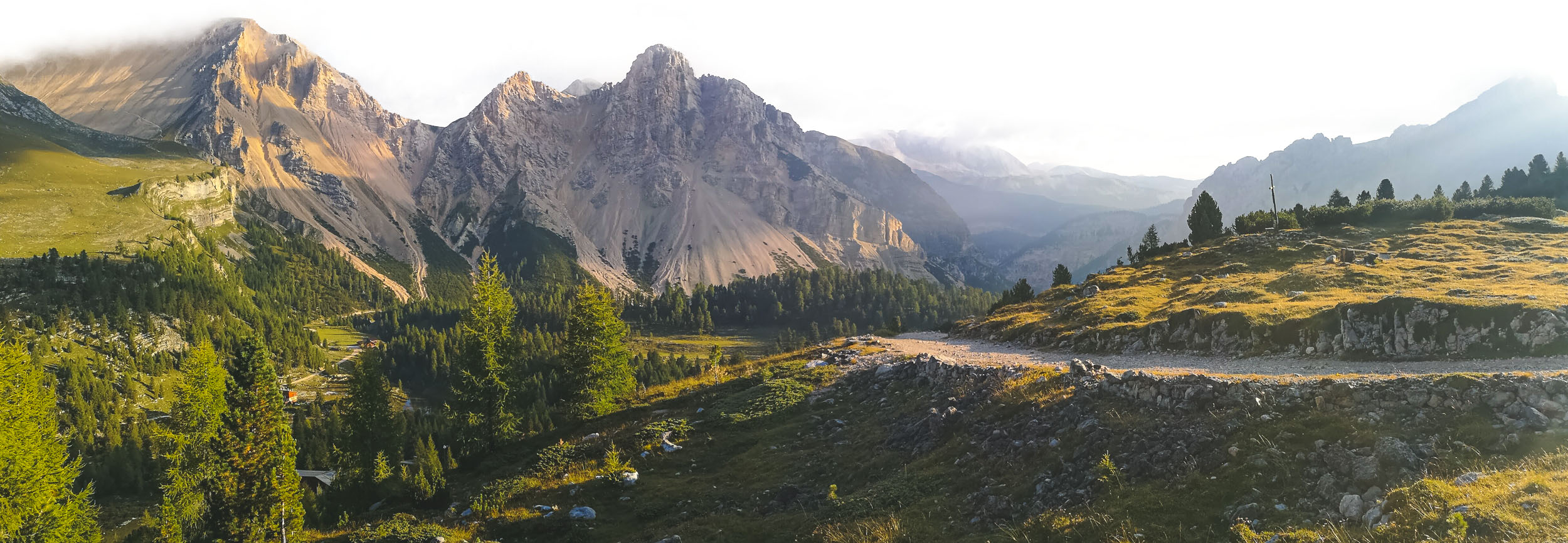
The trail between Rifugio Fanes and Rifugio Lagazuoi covers the rest of the distance in the Fanes Mountains. This is, arguably, the hardest stage of the Alta Via 1 route, but also offers the most majestic views of the first half of the trekking trail.
Trail Stage Details
- Starting point: Rifugio Fanes
- Target point: Rifugio Scoiattoli
- Distance: 19 km / 11.8 mi (Possible shortcut with Cinque Torri Cablecar)
- Ascent: 1 705 m / 5 594 ft
- Descent: –
- Duration: 8-10 h
- Difficulty: Hard – EE (Expert Hikers)
The Highlights of Day 2
Day 2 will start with a peaceful hike through Plan de Sumurones. Photo by Alis Monte [CC BY-SA 4.0], via Connecting the Dots
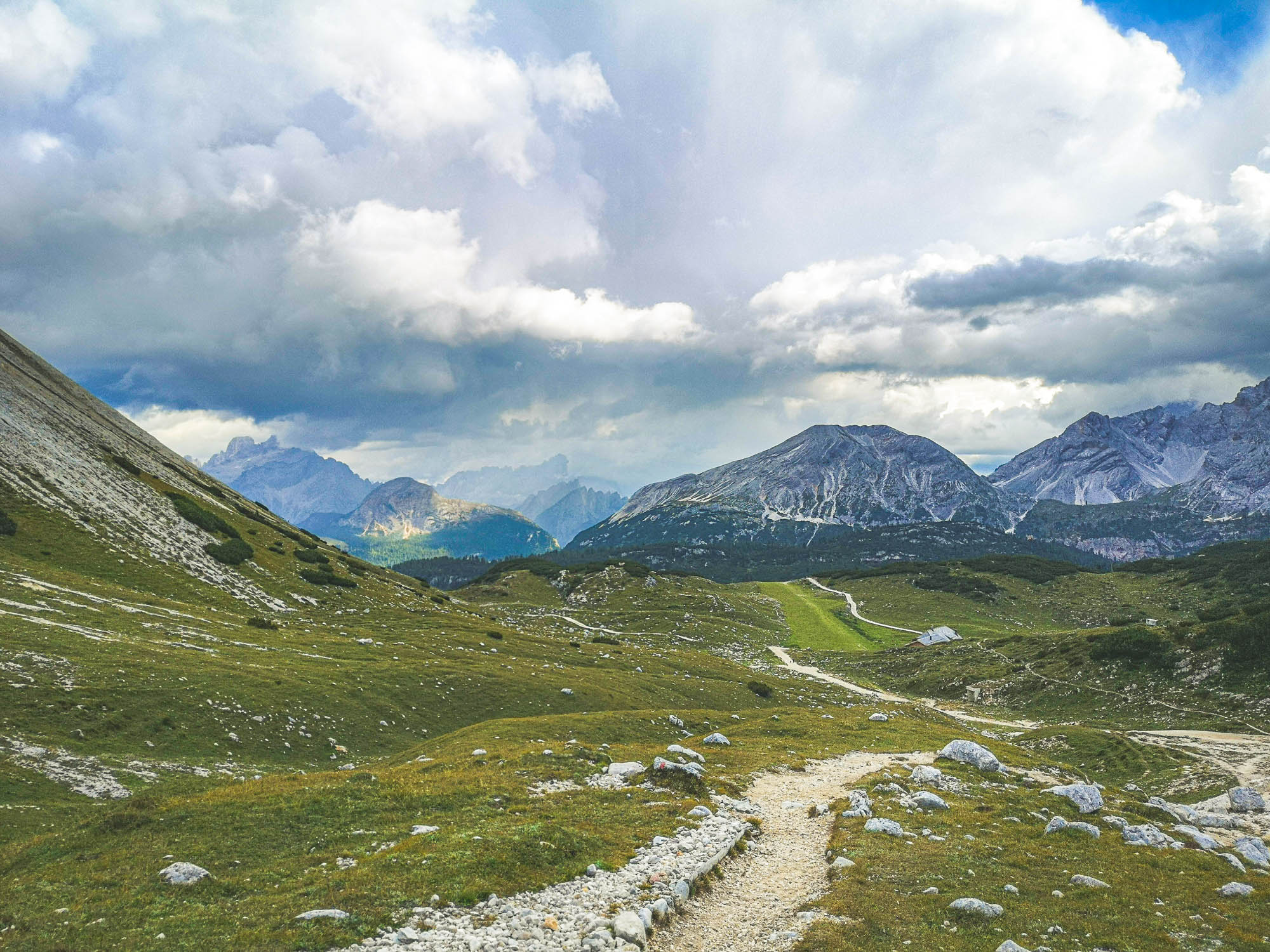
Plan de Sumurones
The beautiful plateau is situated between… and Lake Lagozuoi Saddle. In comparison to the later sections of Alta Via 1 on day 2, hiking through Plan de Sumurones is rather an easy walk without making you sweat. Also, it is a perfect area to look out for edelweiss flowers and charming marmots, thus be sure to embrace the mesmerizing surrounding Fanes before starting your climb towards Lagozuoi.
Col de Locia is a viewpoint towards a big valley. Photo by Alis Monte [CC BY-SA 4.0], via Connecting the Dots
Col de Locia
The beautiful scenic point towards the pre-dolomite plains is the last point before starting the difficult part of the day. It is a perfect spot to take a break and enjoy the awe-inspiring panorama of the mountains. Col de Locia is at an elevation of 2 069 m / 6 788 ft.
The iconic Lake & Mount Lagozuoi vista. Photo by Alis Monte [CC BY-SA 4.0], via Connecting the Dots
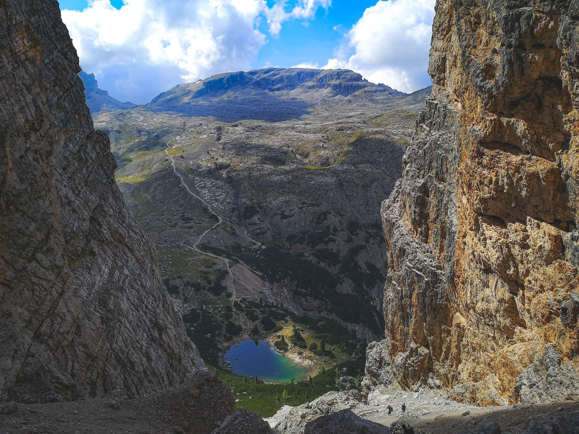
Lake Lagazuoi Saddle
The climb from Plan de Sumurones onto the majestic saddle of Lake Lagazuoi is one of the toughest if not the toughest part of the Alta Via 1 trail. The trail will take you a steep route onto 2 510 m / 8 235 ft tall passage, which will open up one of the most picturesque parts of Alta Via 1 – Lake Lagozuoi with Mount Lagozuoi in the background. It is one of those truly mesmerizing sights and iconic spots that makes this trail so unique and popular. Without a doubt, it is one of the highlights of the Alta Via 1 trail. Once I saw the views from Lagazuoi Lake Saddle on the internet, I knew that I have to go to the Dolomites and see it myself. The vista seems to distort reality as it is hard to understand the scale of the landscape.
Lake Lagazuoi is a majestic reward for climbing the first of the two mountain passages on, probably, the toughest single trail section of Alta Via 1. Be sure to enjoy this beauty mindfully because on the descent from the saddle towards the lake a misstep might be fatal.
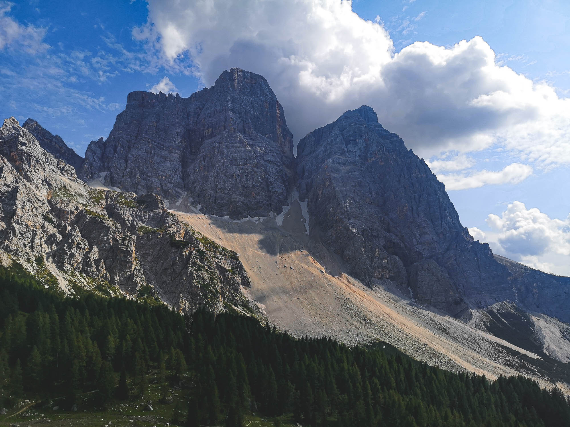
The gigantic twin rock faces towering Lake Lagazuoi are ~ 3.000 m / 9.843 ft Cime Fanis peaks. Photo by Alis Monte [CC BY-SA 4.0], via Connecting the Dots
Lake Lagazuoi
After such a ride, those who dare can enjoy the cold waters of Lake Lagazuoi. It is cold, really cold, even during the summer but if you can cope with cold, the experience will be rewarding. There are not so many places in Europe where you can swim with such great views. If you are not a big fan of cold waters, be sure to at least give it some time to search for fishes living in these tough conditions.
Mount Lagazuoi
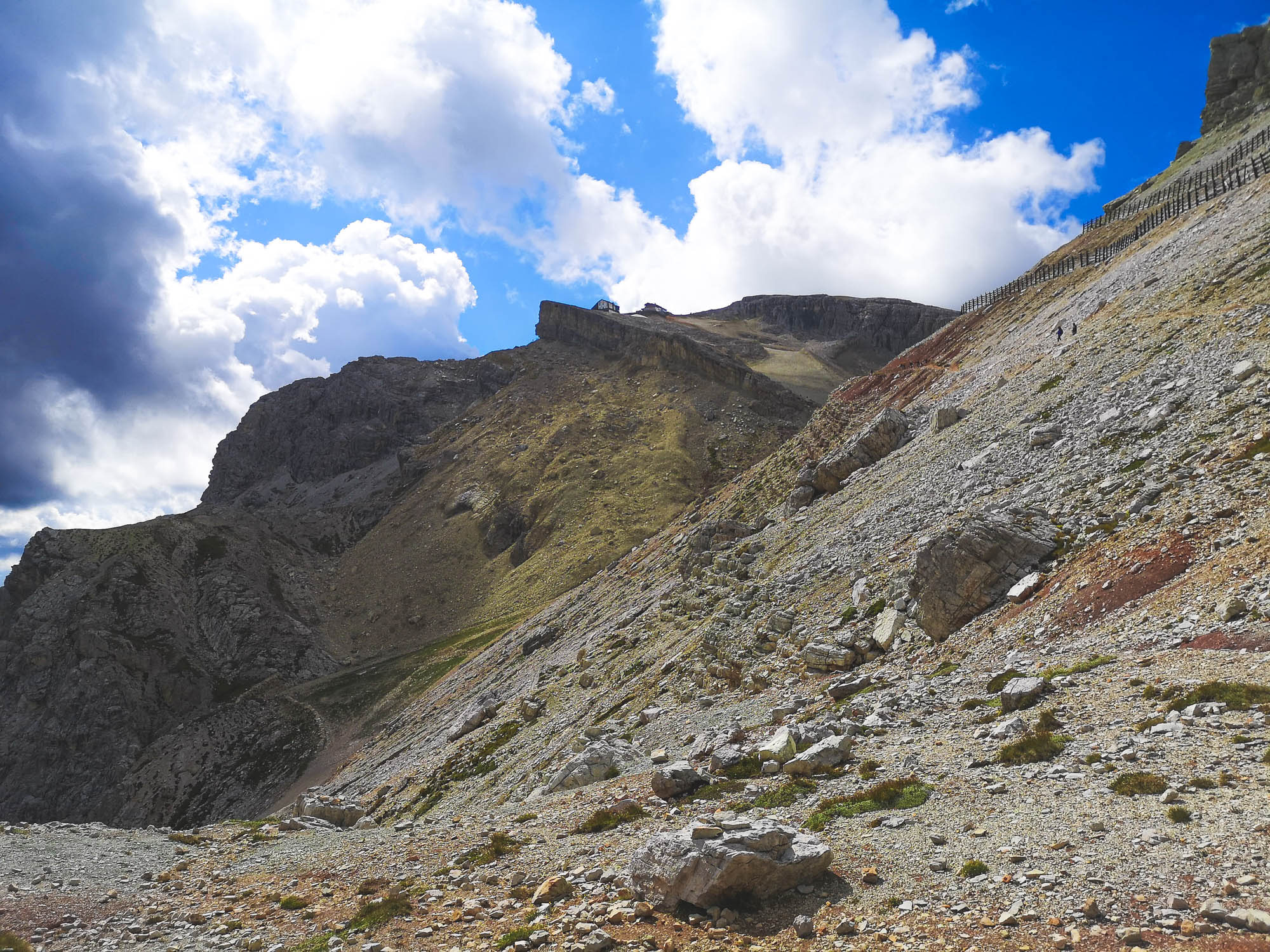
Located almost at the peak of the mountain, Rifugio Lagazuoi is the final destination of the day’s standard section of Alta Via 1. I heard that it does offer fantastic views but I cannot tell personally because Mount Lagazuoi marked only the midway of our chosen distance for the day. At 2 752 m / 9 029 ft, Rifugio Lagazuoi is the highest point of the non-technical version of Alta Via 1. Even without reaching the refuge, I had to admit that the views from the mountain pass were the most spectacular on the first part of Alta Via 1 that I’ve done. Mount Lagazuoi (2 835 m / 9 301 ft) will continue to be visible until the next day.
Rifugio Lagozuoi, 2 752 m / 9 029 ft. The highest and the largest mountain hut in Cortina d’Ampezzo. Photo by Alis Monte [CC BY-SA 4.0], via Connecting the Dots
World War 1 Fortress & Open-air Museum
Beneath the surface of Mount Lagazuoi lies the scars of the painful and unfortunate history of this region. This beautiful natural monument was turned into a fortress during World War 1. Mount Lagazuoi was the Austrian bastion while the Italians used Cinque Torri as their main base in the region. It was one of those World War I trench warfare front lines of meaningless and endless fighting. The Alpine Front was so dreadful that the mountains posed more threat than the enemy itself. With time, it became obvious that the only way to push the enemy frontline was to dig underneath their base and detonate a mine there. It was almost an impossible task to complete, therefore for the most part soldiers were fighting mostly the harsh nature.
You can find World War I museums near Cinque Torri and in Mount Lagazuoi, there are also remains of Austro-Hungarian fortresses by Alta Via 1 route between Lake Lagazuoi and the peak. There are still visible traces of the hardships the soldiers had to endure, living in these tough conditions.

Tofana di Rozes is the most beautiful flower of the Tofana mountains. Photo by Alis Monte [CC BY-SA 4.0], via Connecting the Dots
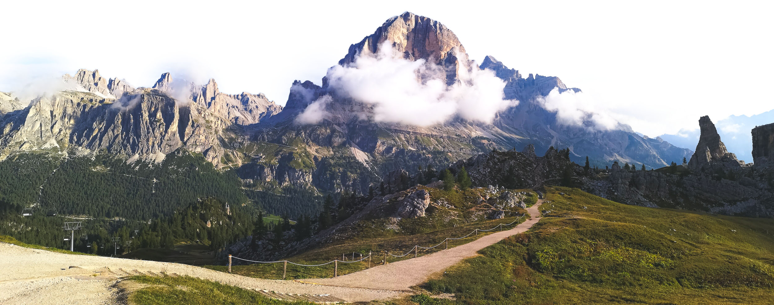
Tofana di Rozes
Even with Mount Lagazuoi in mind, Tofane Mountains highlights the following section of the trail. Out of the all peaks in the mountain group, Tofana di Rozes is the most beautiful one. This prominent mountain gives an impression of a grandiose rock bastion, outclassing everything in its shadow. At 3 225 m / 10 580 ft Tofana di Rozes is only the third tallest peak of the Tofane Mountains. Nevertheless, Tofana di Rozes is the most popular one and for obvious reasons. It dominates the scenery from a popular destination like Cinque Torri and is visible from the famous Italian resort town, Cortina d’Ampezzo.
Mount Lagozuoi and Cinque Torri is separated by Passo Falzarego. Photo by Alis Monte [CC BY-SA 4.0], via Connecting the Dots
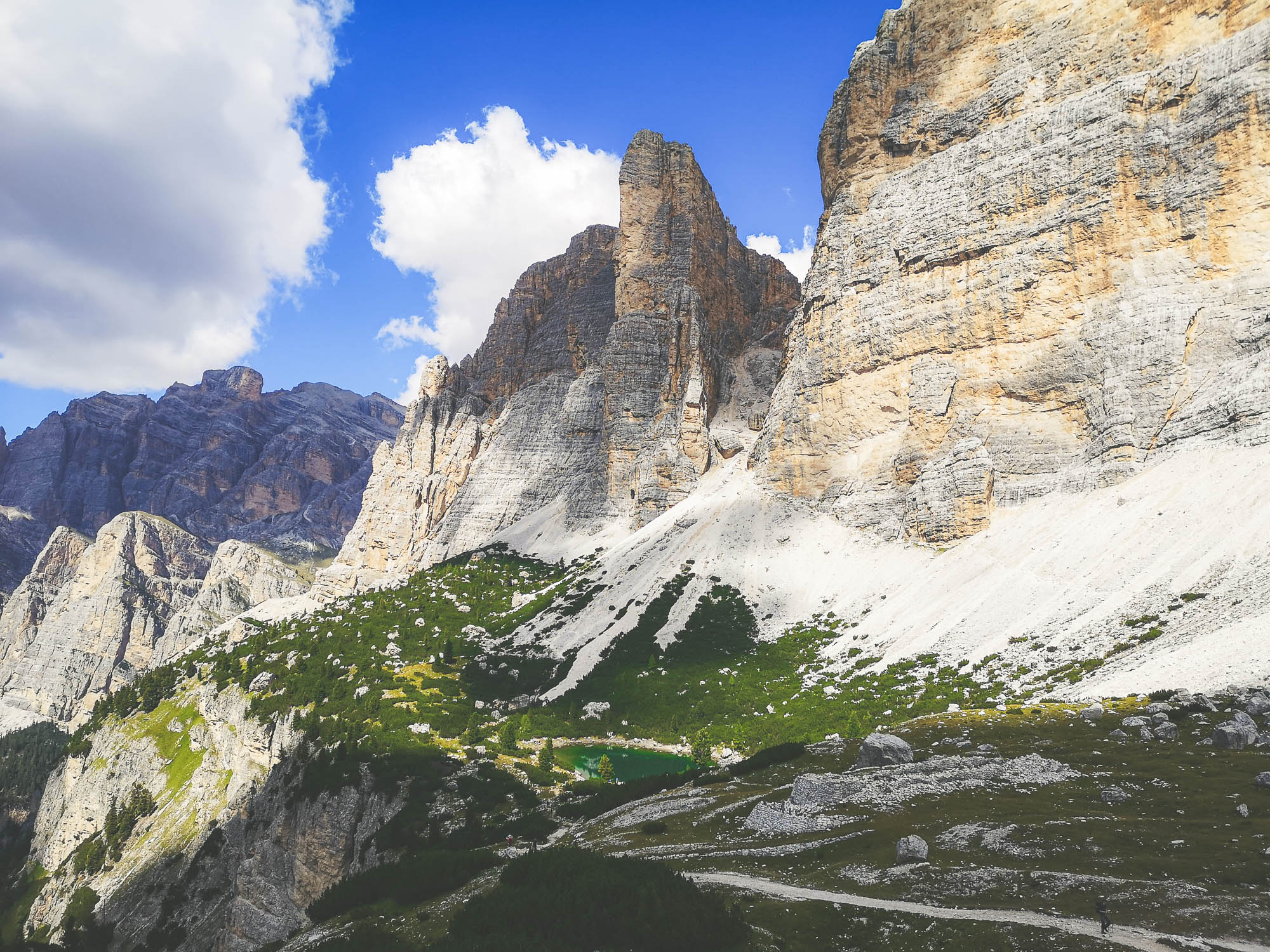
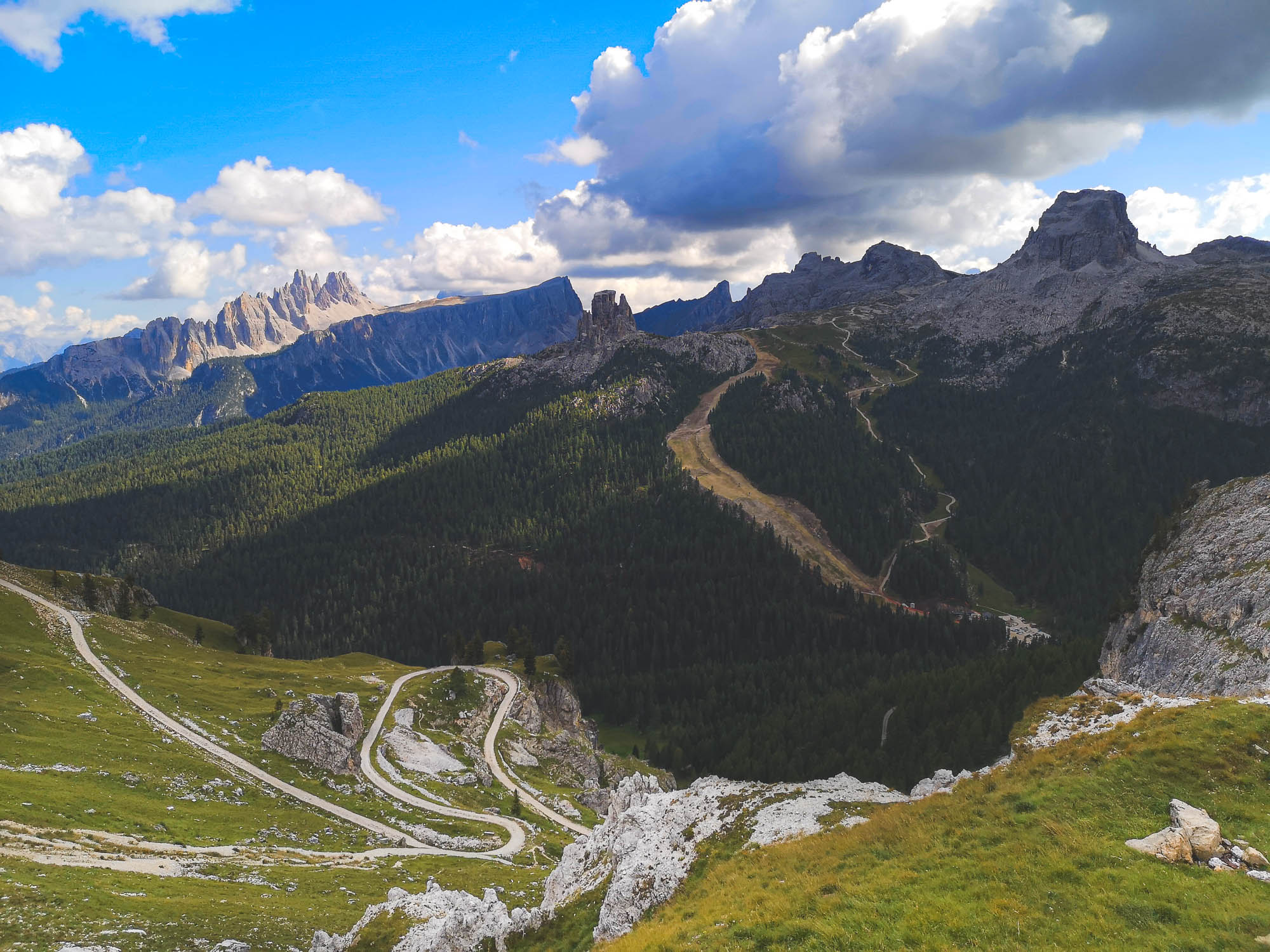
Cinque Torri
This is one of the most iconic rock shapes in the whole of Alta Via 1. Once you are in the area, it is impossible to miss Cinque Torri. Not only the exceptional shape of the rock attracts the eyes of many people but it also serves as the mecca for many rock climbers since the dawn of the sport. The legendary Cortina’s Scoiattoli rock climbing club has trained here since its formation in 1939. Though, because of its visibility from the valleys, I imagine many people have dreamed of doing so for many years before.
Regardless of the rock consisting of more than five blocks, the appearance of Cinque Torri is best described by its name – five towers (direct translation from Italian). Each tower rises between 2.200 m / 7 218 ft and 2 350 m / 7 710 ft above sea level, and each one of those contains a multitude of different level rock climbing routes. To be honest, I hardly saw Cinque Torri rock-climber-free during my visit to Rifugio Scoiattoli.
Despite its distinctiveness, the rock is just a part of the bigger Nuvolau mountain group. Though the whole area looks bizarre, compared to most mountains, Cinque Torri is the most spectacular one. It almost looks like the rock was the work of some sentient beings.
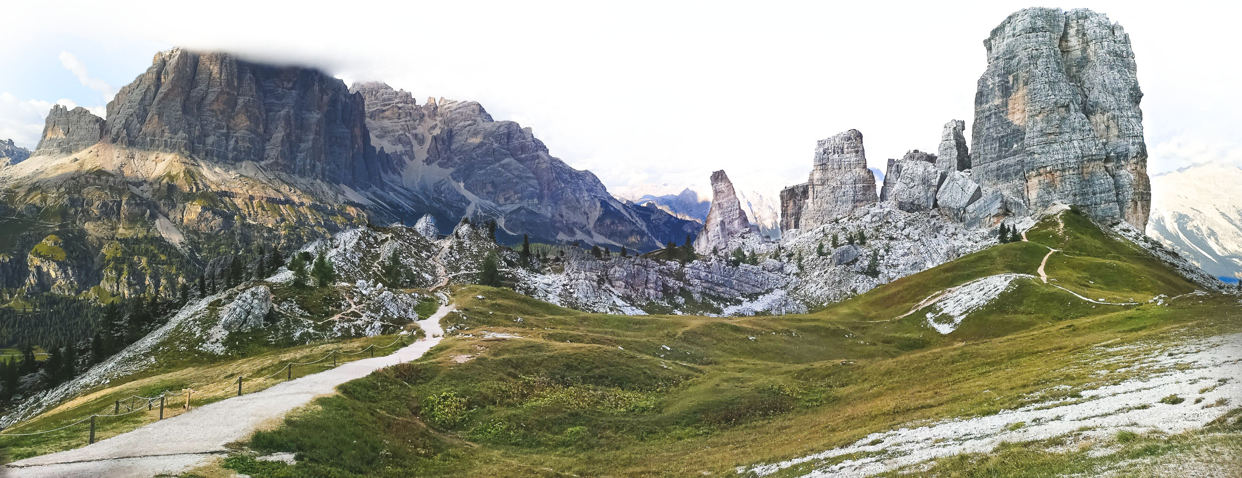
Cique Torri is probably the most spectacular rock formation across Alta Via 1 trail. Photo by Alis Monte [CC BY-SA 4.0], via Connecting the Dots
Day 3: Cinque Torri – Pecol
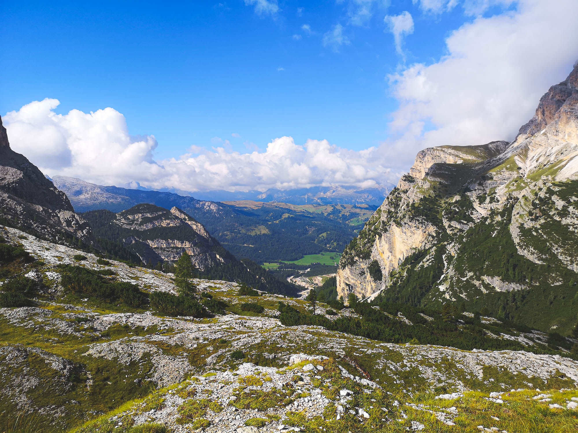
The final day of the 3-day Alta Via 1 route leads us to the Zoldo Valley through some of the best-known landmarks in the Dolomites. Many of them are popular tourist attractions and could be reached with relative ease thanks to the alpine road system. This part of the trail lacks the sought feeling of remoteness in the mountains but tries to compensate with its history and big names. The stretch substitutes two official stages of Alta Via 1:
- Stage 5: Rifugio Nuvolau – Rifugio Città di Fiume (Ascend: 260 m / 853 ft)
- Stage 6: Rifugio Città di Fiume – Rifugio Palafavera (Ascend: 580 m / 1 903 ft).
Trail Stage Details
- Starting point: Rifugio Scoiattoli
- Target point: Rifugio Palafavera
- Distance: 20 km / 12,43 mi
- Ascend: 840 m / 2 756 ft
- Descend: –
- Duration: 8-10 h
- Difficulty: Hard – E (Hike), if you skip via Ferrata
The Highlights of Day 3
The original Alta Via 1 tresspasses Mount Nuvolau via Ferrata. Photo by Alis Monte [CC BY-SA 4.0], via Connecting the Dots
Mount Nuvolau
Though the highlight of Mount Nuvolau Group is Cinque Torri, the whole range is filled with peaks of various bold shapes and forms like Mount Averau and La Gusela. The latter looks from afar like an entrance to a separate Kingdom from a fairy tale. That type of Kingdom, which must be ruled by either Dwarves or Gnomes and maybe it was, wouldn’t surprise me.
Passo di Giau
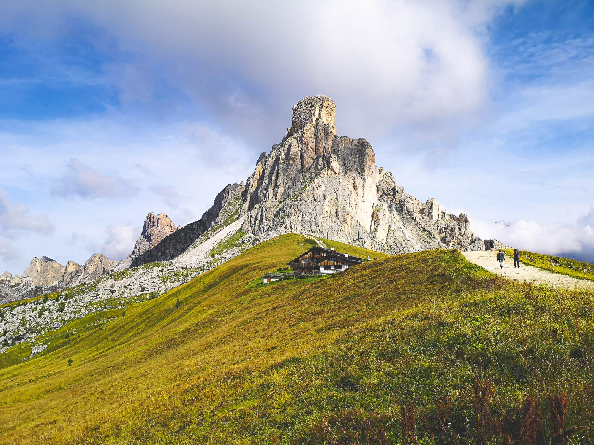
An exceptionally scenic motor road from Cortina d’Ampezzo to Selva di Cadore. It reaches up to 2.236 m / ft at the point, where it crosses with Alta Via 1. Seeing so many cars and people in one place will be quite a shock after so much time in the remote mountains. If the weather conditions are right, Passo di Giau is even open during the winter season.
Passo di Giau towered by Mount Marmolada. Photo by Alis Monte [CC BY-SA 4.0], via Connecting the Dots
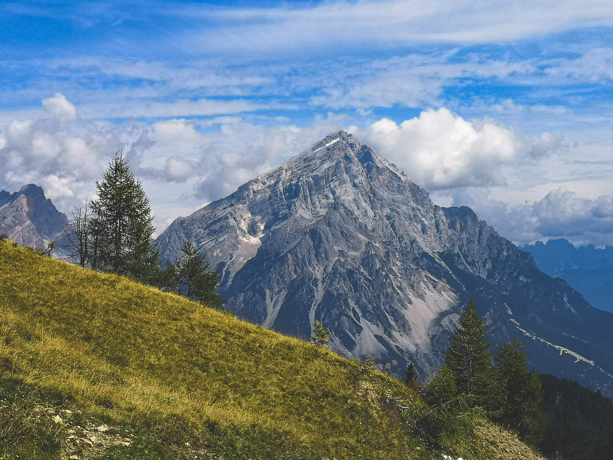
Marmolada
Though Alta Via 1 gives only a glimpse of Mount Marmolada (3.343 km / 10.968 ft) from afar, it is the highest peak in the Dolomites and is worth noticing. It was the only mountain, covered by snow in the Dolomites I saw in September.
The Mondeval Man
It might be not as well known as its slightly older counterpart – Ötzi the Iceman, the Mondeval Man made a lot of noise across the world upon its discovery. Until its discovery in 1987 nobody was aware that Mesolithic hunters were active in high mountains. The Mondeval Man got to 2 150 m / 7 054 ft above sea level, not by a chance. As a matter of fact, he had a proper burial here some 7500 years ago. These high alpine grounds could have been plentiful in-game and water, while at the same time offering some protection from predators.
Monte Antelao (3 264 m / 10 709 ft), the second tallest peak in the Dolomites. Photo by Alis Monte [CC BY-SA 4.0], via Connecting the Dots
Monte Antelao
There are two good reasons to note this mountain: First, Mount Antelao (3 264 m / 10 709 ft) is the second-highest mountain in the Dolomites; Due to its standard mountain-like shape, Mount Antelao would be unnoticed anywhere else, but it does stand out here. Mount Antelao is also known as “The King of the Dolomites”. Surprisingly, it is even visible from Trieste.
Mount Pelmo (3 168 m / 10 394 ft). Photo by Alis Monte [CC BY-SA 4.0], via Connecting the Dots
Mount Pelmo
This giant rock seems to be very unsocial as no other mountain wants to enjoy its company. Mount Pelmo’s (3 168 m / 10 394 ft) loneliness grants it great visibility from all angles. The mountain looks so great that it is nicknamed the “Armchair of God”. Sadly, he seems to be absent from it, maybe he was chased away by dinosaurs some 220 million years ago, whose imprints could be found on the western side.
Mount Civetta was covered by clouds throughout my trip to Alta Via 1. Photo by Alis Monte [CC BY-SA 4.0], via Connecting the Dots
Mount Civetta
This iconic mountain is titled as one of the symbols of the Dolomites. Mount Civetta (3 220 m / 10 560 ft) is thought to be the first major peak of the mountain range to be climbed by a man (1855 by Simone di Silvestro.) Historically, Mount Civetta is considered to be the first 6-tier alpinist difficulty mountain in the world.
Pecol
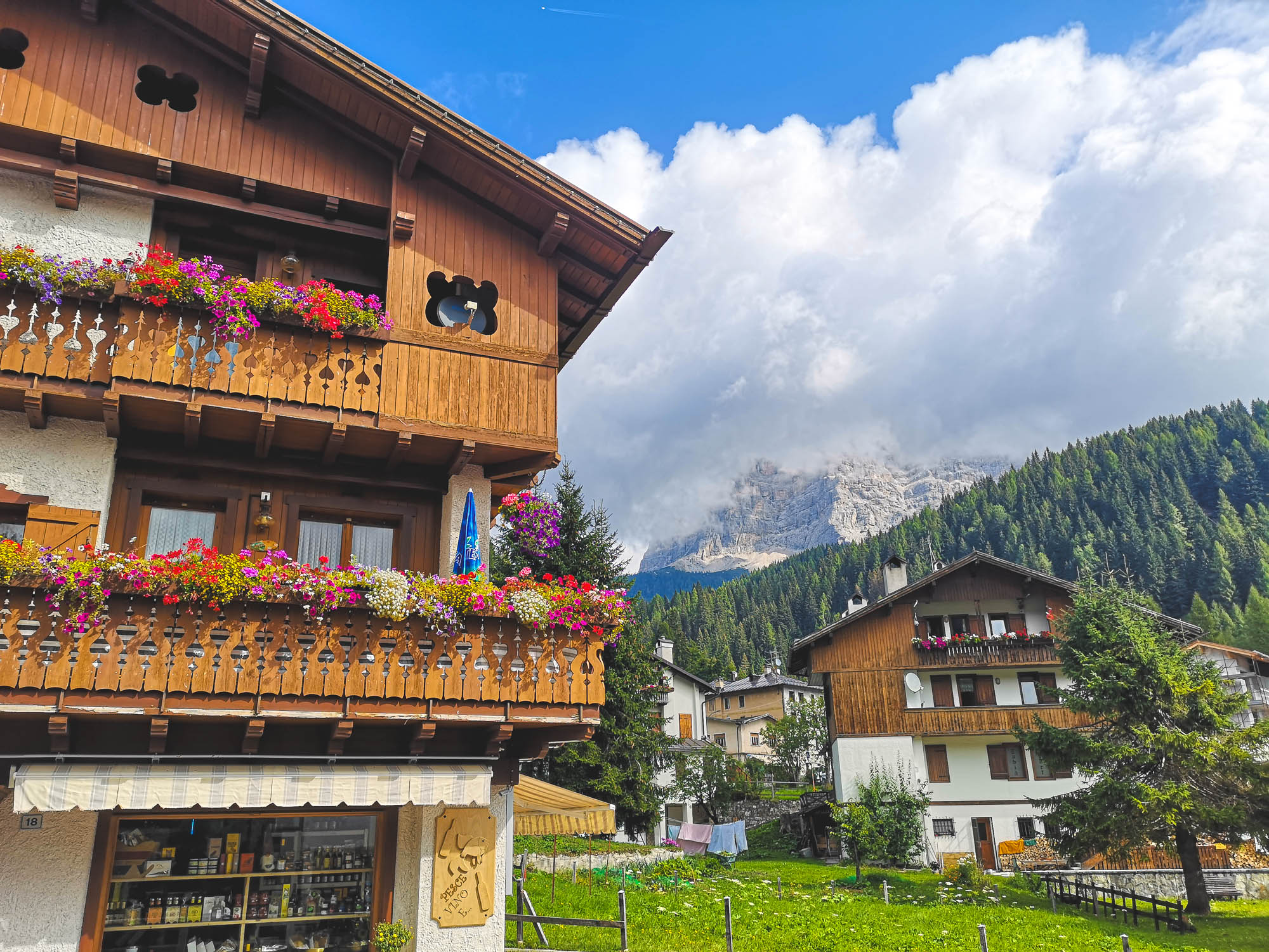
Pecol di Zoldo is the last village, therefore at the highest point, you’ll find in the Zoldo Valley toward Forcella Staunlanza. The town is surrounded by two giants: Mount Pelmo and Mount Civetta.

This is were half of Alta Via 1 ends. Photo by Alis Monte [CC BY-SA 4.0], via Connecting the Dots
Recommended Packing List
Here is a list of gear that you may want to consider bringing with you on Alta Via 1:
- Hiking boots or shoes: You will need a pair of sturdy and comfortable hiking boots or shoes that are suitable for long distance walking on rough terrain.
- Backpack: A backpack with a capacity of at least 50 liters will be large enough to carry all of your gear, including clothing, food, and water.
- Clothing: Bring layers of clothing that can be easily added or removed to adjust to changing temperatures and weather conditions. This can include a base layer, a mid layer, and a waterproof outer layer.
- Sleeping gear: A sleeping bag, sleeping pad, and tent will be necessary for overnight stays on the trail.
- First aid kit: It is always a good idea to bring a basic first aid kit with you on any hike, including items such as bandages, gauze, and over-the-counter medications.
- Water and food: Bring enough water and non-perishable food to sustain you for the duration of your hike.
- Maps and a compass: A map and compass will be essential for navigation on the trail.
- Other items: You may also want to bring a headlamp, sunscreen, insect repellent, and a multi-tool or knife.
It is always a good idea to check the weather forecast and prepare accordingly before embarking on any hike. Make sure to bring the right gear to ensure that you have a safe and enjoyable experience on Alta Via 1.
Personal Experience
Mountains always fascinated me. Trekking the Dolomites on Alta Via 1 is something of a dream come true. As much as it is a blessing, it could be a curse, therefore it was very hard to weigh in on what I can and cannot do. I have little mountain trekking experience, but I spent hours and hours hiking on terrains like this and climbed some high peaks like Mount Kazbek (5.054 km / 16.581 mi). That is enough to understand that generally, mountains are a very dangerous place if you don’t abide by their rules. Given this, it was easy to understand if I wanted to do sections of Alta Via 1 at this pace, but it was tough to judge if I could. In the end, I found it easier than I expected and probably I could’ve done the whole Alta Via 1 without losing the tempo. Nevertheless, I cannot recommend walking 20 km / 12.42 mi a day in the Dolomites, unless you know what you are doing.
If you are not as confident in your strength, you’ll find the itinerary too tough. The love for mountains or the desire to complete another thing from your bucket list alone is not enough, you need the passion for trekking to cover 20 km / 12.42 mi a day on this terrain. The good news is that the roads of Alta Via 1 are relatively gentle, thus the famous trek could be done by most of us. Everybody just needs to find their own pace and distance between the refuges. After all, just a bit of the majestic Dolomites is enough to rejuvenate the souls, so don’t stress out if you can’t complete the whole distance at once. There is always time to return and complete other sections of Alta Via 1.
Alta Via 1 taught me many things. I’m still not sure about the afterlife, but now I’m confident that heaven exists.
All content and photos by Alis Monte, unless stated differently. If you want to collaborate, contact me on info@ctdots.eu Photo by Alis Monte [CC BY-SA 4.0], via Connecting the Dots
Frequently Asked Questions
How long does it take to hike the Alta Via 1?
The duration of the Alta Via 1 trek depends on various factors, including your fitness level, hiking pace, and the specific itinerary you choose. On average, hikers complete the entire route in about 10 to 15 days. However, some may opt for shorter sections or extend their trip to explore the surrounding areas. More experienced hikers can do it in 6 days.
Is the Alta Via 1 difficult?
The Alta Via 1 trek is considered moderately challenging. It involves steep ascents and descents, rugged terrain, and high mountain passes. Adequate physical fitness and prior hiking experience are recommended to fully enjoy the trek. However, with proper preparation and a reasonable level of fitness, it can be an achievable adventure.
What is the best time of year to hike the Alta Via 1?
The best time to hike the Alta Via 1 is typically during the summer months, from June to September. During this period, the weather is generally more stable, with milder temperatures and less snow in the higher elevations. However, it's important to check the local weather forecasts and trail conditions before embarking on the trek.
How much does it cost to hike Alta Via 1?
The cost of hiking the Alta Via 1 can vary depending on several factors, including accommodation choices, transportation, meals, and equipment. Accommodation options range from mountain huts to hotels, with varying prices. On average, budgeting around €40 to €80 per day for accommodation and additional expenses is a reasonable estimate.
Which Alta Via is most beautiful?
Both Alta Via 1 and Alta Via 2 in the Italian Dolomites offer breathtaking scenery and stunning landscapes. Beauty is subjective, and personal preferences may vary. However, Alta Via 1 is often regarded as the more scenic and popular option, taking hikers through dramatic mountain passes, iconic peaks, and picturesque valleys.
Which is better, Alta Via 1 or 2?
The choice between Alta Via 1 and Alta Via 2 depends on personal preferences and hiking goals. Alta Via 1 is known for its grand mountain scenery and iconic peaks, while Alta Via 2 offers a more remote and wild experience. It's advisable to research both routes, consider your hiking abilities, and select the one that aligns with your preferences.
What do you wear on Alta Via 1?
When hiking the Alta Via 1, it's essential to wear suitable clothing and gear. Dress in layers to accommodate changing weather conditions. Opt for moisture-wicking and breathable fabrics for comfort. Hiking boots with good ankle support, trekking poles, a backpack, a hat, sunglasses, and sunscreen are also recommended.
How many miles is the Alta Via 1?
The exact distance of the Alta Via 1 can vary slightly depending on the specific route and detours taken. On average, it covers approximately 125 kilometers (77.67 miles) from its starting point in Lago di Braies to the end in Belluno. It's worth noting that the distance can be extended if hikers choose to explore side trails or make additional detours.